___Moonracer Farm OTRA
  • MRF OTRA Blog
  • Moonracer Farm OTRA
  • Capitols Visited
  • Contact Us

Big Bend Ranch State Park + 2 Forts

2/21/2023

0 Comments

 
We only booked at BBRSP because the National Park campground was full, and we weren’t sure what we were going to find because the booking process was unclear to us.  Many locations were listed on the Reserve America site, but no campsites, and while that booking engine normally makes it very clear what is provided and what is allowed at each campsite, for this park it was anything but clear.  Only one location listed a maximum RV length of 30’, so we decided to book there for two nights.  We also decided that we would be very sure to get to the Barton Warnock Visitors’ Center well before closing so we could ask lots of questions and figure it out.​

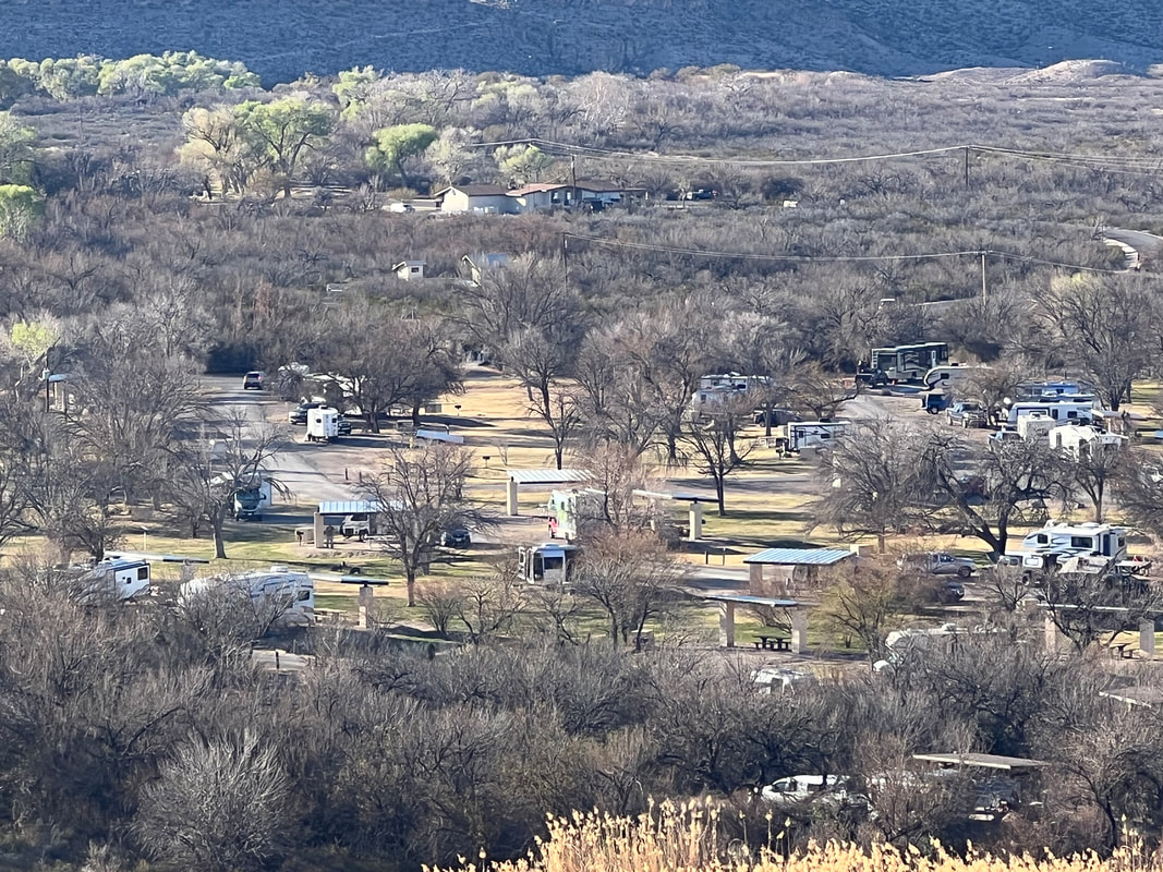
After finishing our hike in the National Park and driving out the western gate, we basically followed the river to the BBRSP Visitors’ Center and arrived right around 3PM.  The ranger looked like she was used to dealing with confused people, and she pulled out a map and highlighted the La Cuesta camping area, which was about 15 miles farther on the river road.  She explained that it was basically a boat launch, but that they had four designated camping spots for RVs, provided the RVs were completely self contained.  She told us to pick any empty site, and gave us a receipt to tape to the windshield.  Sure enough, La Cuesta was clearly marked, and the campsites were clearly defined by guardrails like you see around curves at the edge of the road.  Each corral had a picnic table and a fire ring, and the opening was plenty wide enough to comfortably park a fairly large rig.  Unfortunately the whole lot slopes down towards the river, so we had to use all of our boards under the riverside tires to get anywhere close to level, but it turned out to be clear and easy.
Picture
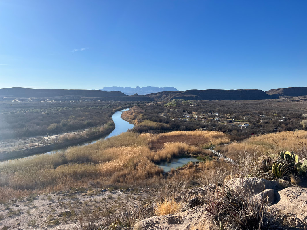
We took a walk down to the river and looked across at Mexico [again], although by this point we were pretty used to being within spitting distance of Mexico.  We met another couple traveling in their Winnebago Ekko and their friend who is traveling in an almost identical vehicle, and compared notes on our travels.  They were following the same path as we are, and had noticed us at BBNP - go figure!  We talked about what was available to do in the area, and retired to our campers.  Despite the fact that the “campground” is just a parking lot on the side of the road, the night was very quiet since the road gets very little traffic after dark.​

We spent the next day exploring the area.  Two short nearby hikes allowed dogs, so we did those hikes, as well as a loop hike on a 4WD road.  Dogs are allowed anywhere vehicles can go, so we took the dogs on that longer hike as well, which turned out to be a mistake since they all had sore feet from walking 5 miles on the sharp stones.  We completely respect the reasons dogs aren’t allowed on most trails at all of the parks in the area, and one of those reasons is that the footing is hard on their feet.  We thought they’d be okay on the 4WD track since there isn’t any sharp and pointy vegetation, and it isn’t very hot right now, but even without those factors, they all ended up lame, with Kismet not even wanting to walk outside for a couple of days.  A few days later they’re all fine, but we learned a good lesson about taking our jungle dogs into the desert.
Picture
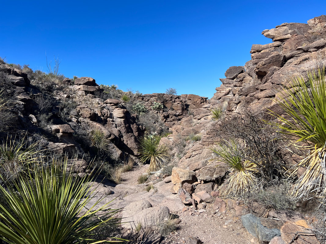
Our first hike was on the Hoodoos Trail. Hoodoos are large rocks with mushroom-like tops formed when the bottom of the rock is eroded.
Picture
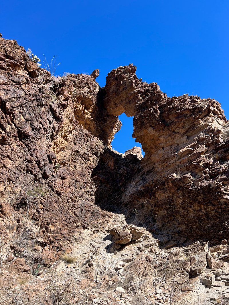
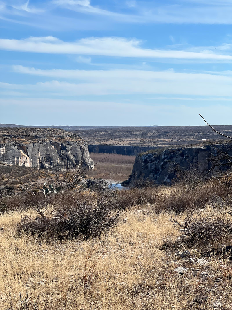
We then hiked on the Las Burras Mesa trail, where we saw these caves in the cliffs at the end of the trail.
Picture
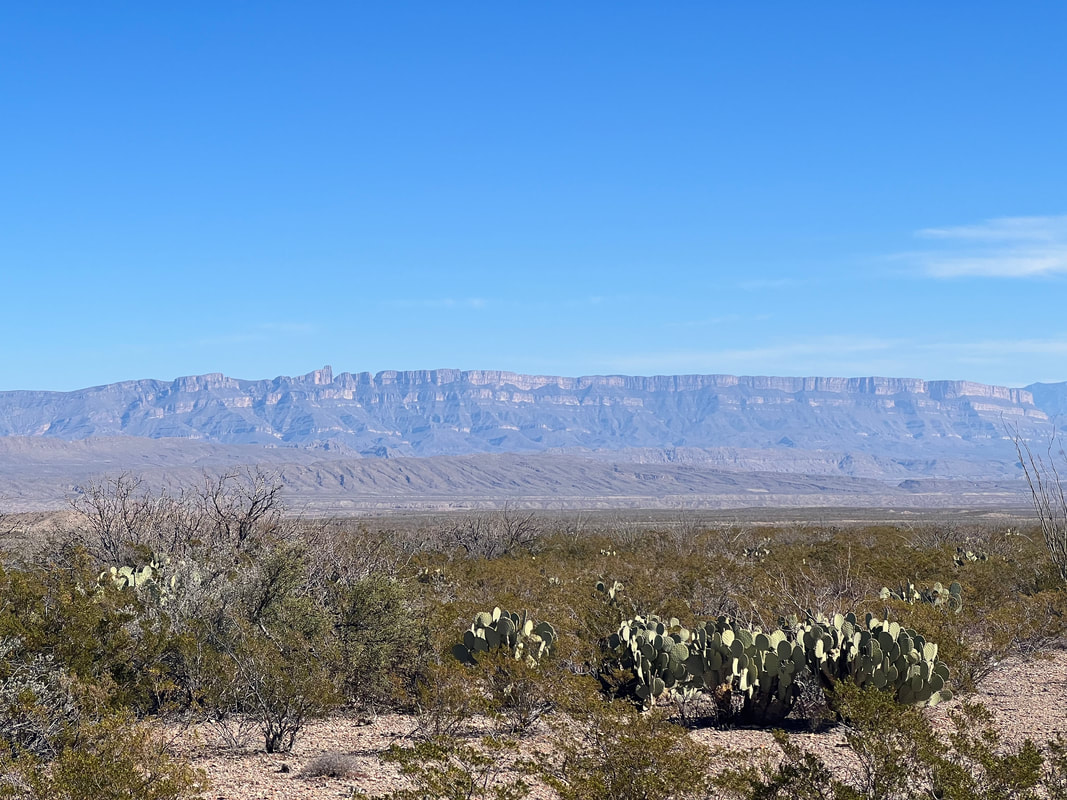
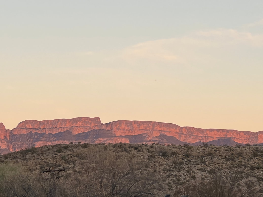
The trail was a 4WD loop from the main road back to the base of these mountains. As we’d been driving, we’d often wondered how far from the road the mountains started. In this case, it was about 2 miles, although we’d climbed over 700 feet from the road to the mountain base over that 2 miles.
Picture
We had seen this obviously foreign object from way back on the trail and had been discussing what it was. I said it was a crashed space ship, joking of course, but in line with the theme of the area. Tom thought it was the bad of a cement mixer. Turns out we were both right, since it was in fact the back of a cement mixer, dumped on this spot and painted to look like a crashed space ship.
Picture
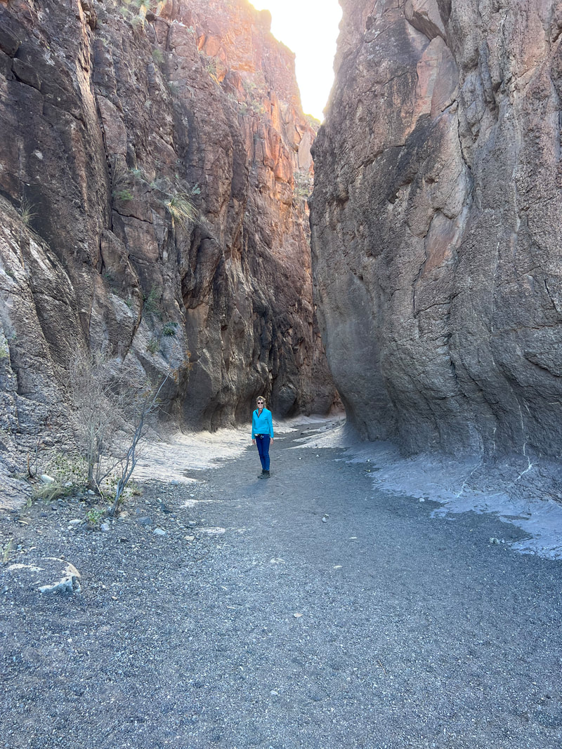
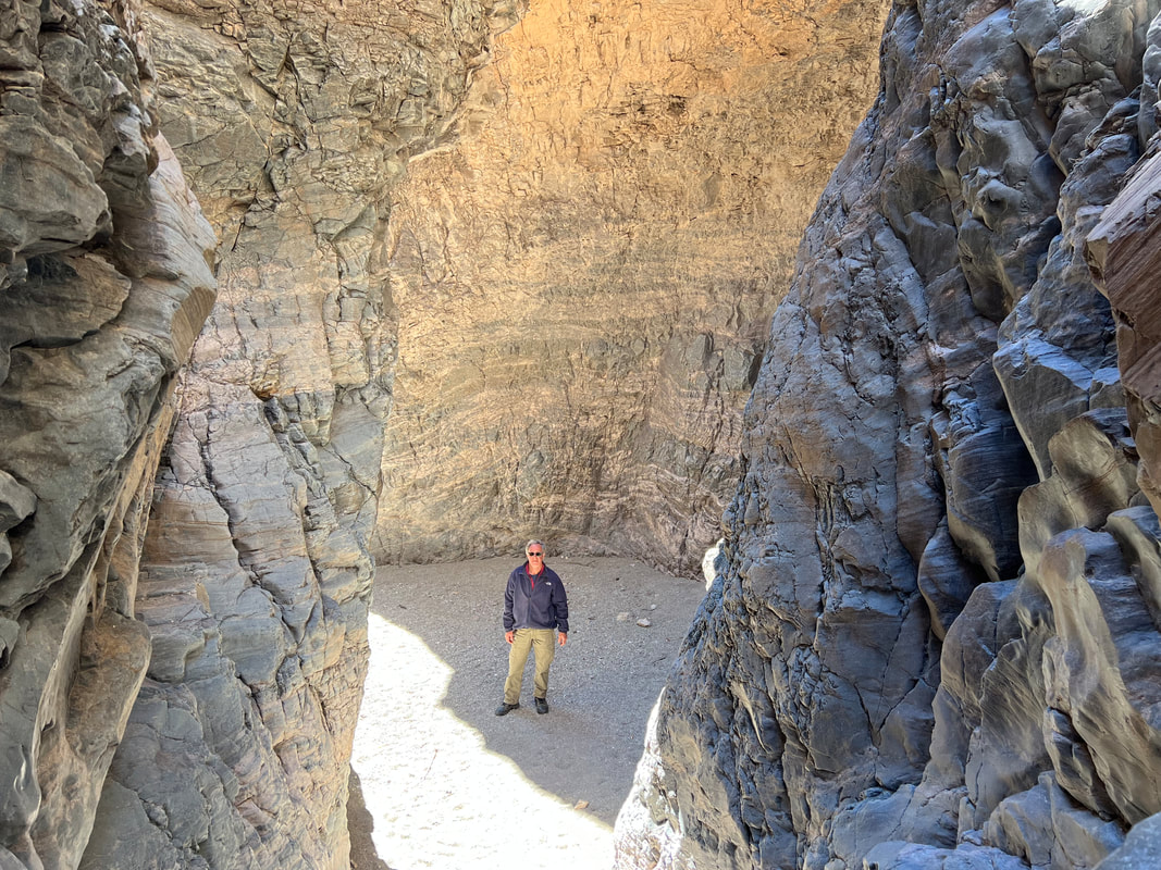
Our last hike of the day was on the Closed Canyon Trail, which ran down a dry creek bed through a 15-story canyon.
Picture
​The next day we left the site and headed north.  Before we left the park, we stopped at the Fort Leaton Historic Site, which is run by the BBRSP.  We planned to visit Fort Davis National Historic Site at the end of the day, and knew the forts were all connected, so we figured we would get some good background, which we did.  However, we ended up leaving there later than expected because as we returned to the truck, we saw police trucks with flashing lights surrounding our vehicle.  Tom approached the closest officer, and asked if there was a problem with our truck.  The officer explained that we had nothing to do with it, and they had just made a traffic stop, and pointed to a small white car on the other side of our camper which was, to us, completely out of view.  They asked if we would mind waiting while they finished, and Tom said we wouldn’t, especially since the police trucks with lights flashing were blocking the exits.  We went in the camper and peeped through the windows to watch as they arrested and handcuffed the driver, a young man, and then proceeded to sort through the garbage pile that filled every inch of his car besides the driver’s seat, pulling out vials of what we assume were drugs.  When it looked like this search could go on for the rest of the day, Tom asked again if it would be possible for us to leave, and after a brief conference among the officers they moved one of the trucks blocking the exit and we were free to go.
Picture
We knew we needed to stock up on groceries again, so I looked at Google and found a regional grocery chain called Porter’s in Presidio, the next town.  There were other Porter’s in towns we would be passing, but we decided to get the shopping out of the way.  Porter’s turns out to be an extremely well stocked midrange grocery, with good produce and excellent meat.  And, because they seem to have a mostly Mexican clientele, I was able to get a lot of supplies I’ve been missing in the US grocery chains since we left Belize, with the exception of the Puerto Rican grocery our friend Rhea took us to in Sarasota a month and a half ago.  After stowing the groceries in the camper, we grabbed some cheese and crackers and headed for the Fort Davis National Historic Site.​

Fort Davis and Fort Leaton were connected, although Fort Leaton was run by a series of families through the years, where Fort Davis was a much larger fort run by the military.  Many of the buildings that made up the fort are now no more than stone foundations, but there are a few completely refurbished buildings, as well as a few in the process of being repaired.  We left our sore-footed dogs in the camper and spent about an hour and a half walking around the grounds, looking at foundations and peering in windows.  We were a little worried that we wouldn’t have time to see anything since we hadn’t arrived until 3:30, but the hour and a half turned out to be just about perfect.
Picture
Picture
Picture
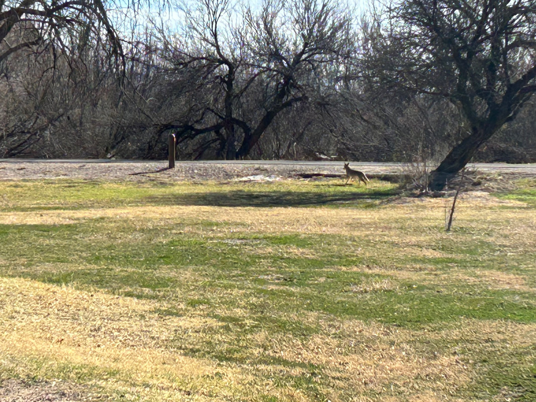
​We decided to head towards Guadalupe Mountain National Park, even though we knew we couldn’t make it that night.  We had learned that all Texas rest areas allow overnight camping, and all of the areas we had passed had more than ample space for a number of rigs.  On the way, we were watching what was to us an Unidentified Flying Object, trying to figure out what it was.  It didn’t move, and our path took us close enough that Tom took a pretty good photo, which I posted on Facebook to find out what it was.  We discovered that it’s an aerostat, used by Customs and Border Patrol to monitor border activity of people and goods.  Shortly after that, we came to a rest area just south of Van Horn, and decided that was a good place to park.  A man was there doing landscape maintenance, and we asked him if it was okay to park for the night since there was nobody else there to talk to, and he assured us that Texas is proud of their rest areas and their policy that allows tired travelers to pull off the road and get a good night’s sleep.  We were there just in time to catch the sunset, and had a very quiet night although Tom said he heard one train overnight on the tracks on the other side of the road.  We heard coyotes yipping and howling in the distance just as we were getting ready to pull out in the morning, but nobody gave us any trouble and it looks like the system works.
Picture
Picture
0 Comments

Big Bend National Park

2/21/2023

0 Comments

 
We left Seminole Canyon State Park on Thursday morning and drove to Big Bend National Park.  We covered the remaining 80 miles of “no services” road through the desert, watching the changing landscape as the hills turned into mountains.  We continued on to Marathon where we stopped for groceries.  We had stocked up in Eagle Pass at an HEB before going to Seminole Canyon, and had expected that we would pass another grocery store along the way to Big Bend NP.  When we reached Marathon, we were surprised to find that the grocery store was basically a camp store called The French Grocer, which had minimal selection for produce, and a lot of overpriced basics.  We decided it would be better to suck it up and get things like overpriced frozen vegetables rather than driving further into Alpine and spending in fuel and extra mileage what we would have saved by shopping elsewhere.  ​

We continued south to the park through a lot of nothing but beautiful desert and mountains.  The road from Marathon turns into the park road, and after checking into the park, we continued another forty miles or so to the Rio Grande Village Campground where we had managed to book one night, stopping at pull offs along the way to take photos.
Picture
​We pulled into the campground and found our spot.  I took the dogs for a walk on the grass while Tom set up the camper, and the first thing I saw was a coyote just wandering through the campground.  I yelled to Tom to come out with his camera, and one of the rangers heard me and moved to shoo the coyote out of the campground, but not before Tom got a few photos.  I then continue to let the dogs wander through the grass, where I saw many kinds of poop.  After settling the dogs in the camper, we went to find the camp hosts, whom we had met in New Orleans at Faubourg Brewery.  I mentioned the coyote, and Nancy told me that the coyotes go through fairly frequently, as well as javelinas (which we know as collared peccaries), as well as horses and cows which cross into the campground from Mexico.  That explained the wide variety of poop!
Picture
Picture
​The campground is right on the Rio Grande, so we took a wander on the trail that runs around the campground and went down to the river to touch the water and take another look at Mexico, which is much closer to Big Bend National Park than it is to Laredo since the Rio Grande isn’t quite so grand closer to the headwaters.  The landscape surrounding the campground is stunning, so we spent more time taking photos than walking.  We were surprised when we looked at a map and realized that the campground is on an oxbow in the river, so the majestic mountains surrounding it are all in Mexico.
Picture
Picture
Picture
​We spent a quiet night in the park and didn’t hear any planes, trains, or automobiles, other than the odd camper leaving super early the next day.  Because we could only book one night, we had booked two more nights at the Big Bend Ranch State Park on the other side of the west entrance to the national park.  Our plan was to take a drive down the Ross Maxwell Scenic Drive, with stops for a few short hikes.  We only made it about eight miles down the scenic drive, however, because we stopped for a hike on the Upper Burro Mesa Pouroff trail which, despite being only about 3.5 miles, took us almost two hours by the time we climbed around a bunch of boulders in the wash and took a bunch of photos.
Picture
Picture
Picture
​We got back to the camper around 1PM, so we decided to get lunch and head to the state park, where we could sign into our campsite there after 2PM.  This meant we didn’t drive the rest of the Scenic Drive, but we didn’t know what to expect with the state park camping situation and wanted to give ourselves plenty of time to get to the visitors’ center there before it closed so we could find our campsite and get settled well before dark.  We ended up being very happy with this decision, since the Big Bend Ranch State Park camping situation is very different than anything else we’d encountered so far on our trip.
0 Comments

Seminole Canyon, Fate Bell Shelter

2/21/2023

0 Comments

 
When we booked our stay at Seminole Canyon State Park, our plan had been to take the guided tour to see the rock art on Monday or Tuesday, and leave the park on Wednesday.  However, the only way to see the rock art is to go on a guided tour, and the tour doesn’t run on Mondays and Tuesdays.  So, we extended our stay by a day and signed up for the tour on Wednesday morning.  At the ranger’s recommendation, we booked on line, and it was a good thing we did since the tour was full.  ​

The tour meets in the Visitors’ Center, and the tour guide leads the group into the canyon to see the rock art in the Fate Bell Shelter.  Fate Bell was the rancher who owned the land before it was turned into a state park.  On the way down into the canyon, Jerri, our tour guide, explained the history of the canyon, both ancient and modern as far as humans go, as well as the natural history of the geology, the flora, and the fauna.  Even with this background buzzing in our brains, it was still a thrill to look up and see the first evidenced of the cave paintings. 
Picture
The cave paintings are in a couple of connected rock shelters, and after looking at the first set we proceeded down the canyon to see the rest.  We were fortunate that the tour group was a very good group, with everyone attentive, engaged, and polite.  Everyone took turns getting close to the art and taking photographs, and respected Jerri’s instructions.  One of the things I found interesting which was outside the history was that my iPhone camera was better at seeing the art than my eyes, and when I had difficulty deciphering a drawing, I could take a photo and see it much more clearly. ​
Picture
Picture
Picture
​At the end of the tour, Jerri turned us loose to make our way out of the canyon, which allowed us to get a second look at things we wanted to see again.  For us, this was things that she’d pointed out in passing such as the many fossils in the rocks in the canyon.
Picture
Picture
0 Comments

Lake Casa Blanca SP to Seminole Canyon SP

2/7/2023

0 Comments

 
Our two days at the Lake Casa Blanca State Park in Laredo went as planned.  On Friday, we hiked around the park. They don’t have a lot of nature trails, but they have one trail that winds through the sage brush, and then you can walk through the park along the lake.  We found another small trail near the campground that runs by a church ruin and then around the top of a small hill, giving a view of the surrounding area so you can see the layout of the park.  The weather was just about perfect, with sunshine, a slight breeze, and temperatures in the mid-60s.
Picture
Hiking at Lake Casa Blanca State Park. Don't worry, Ty is there, in front of Tom.
Picture
An old church in the park, which used to be a museum, but which is now just a ruin.
On Saturday, we took out the e-bikes and biked a trail that runs through the city to the Rio Grande.  Getting there was a little tense since the park is wedged between two very busy state highways, each with two lanes running in both directions.  However, both highways have sidewalks on both sides of the road, so we rode the bikes along the sidewalk and it wasn’t too bad.  We know bikes are supposed to follow traffic laws, but we didn’t see any pedestrians on the sidewalks, and we did see a lot of bicycle tire tracks in the sandy spots along the way.  We found a way to get to the trailhead through neighborhoods to minimize the time on the highway, which caused a brief burp when we arrived at a gate where we had apparently pedaled into a gated community through an open back gate.  The gate didn’t seem to have any sensors to open for a couple of wayward cycles, but some resident took pity on us an opened it remotely.​

From there we quickly found the trailhead and headed towards the river.  On a beautiful sunny Saturday, we only saw one other bicycle, and a few walkers, which surprised us since the trail runs through a few city parks where we did see people enjoying the day, although they must have driven there rather than walked or bicycled.  The trail is fun to ride, very twisty and windy, and it crosses bridges and runs under overpasses so we didn’t have to stop at all.  All of the sudden we saw a big waterway in front of us and realized we’d arrived at the Rio Grande at the end of the trail.  We pulled up and looked at Mexico and took some photos.  We didn’t see a wall, we didn’t see hordes of migrants swimming across the river, and the only reason we even knew we were at the border was because there were a couple of floodlights and one truck with a few soldiers in the park at the end of the trail on the US side.  We discussed packing up and heading back into Mexico for a month or so, but decided that with the expense of getting the truck insured, and getting an international vet certificate for the animals, we were probably better off continuing our trip in the US.  We retraced our path back to the campground, and packed up so we’d be ready to head to Seminole Canyon State Park in the morning.
Picture
Ah, Mexico. So close but yet so far. And not a swimming Mexican in sight. And where's the damned wall???
Sunday morning, we packed up and headed north, following the river.  We’d already made reservations at a primitive campsite at Seminole Canyon, so we made sure to fill our water tank and empty our gray tank.  Ever since the ice storm, we’d been staying at campsites so we could plug in and use the heater, and that also meant that we could charge our batteries, so we were heading out with 100% charge on our batteries as well.  All good, right?

Somewhere along the drive, I took a look at our battery status and realized that we weren’t getting any charge from the solar panels.  We didn’t worry too much because previously we’ve had to turn things off and on and switch some switches to get things running correctly after we’ve been plugged in to shore power.  When we stopped to get lunch and do some shopping, Tom switched the switches and figured that when we were ready to leave and he turned things on again, everything would be working as usual.  But, nothing had changed.  We continued on our way to the park and planned an overnight hard shutdown to kickstart things.​

We arrived at Seminole Canyon State Park around 4pm.  This park is truly in the middle of nowhere, and as we had driven out of the last town on the road before the park, we had noticed a sign warning that there were no services on the route for 88 miles.  So far in our travels, I don’t think we’ve gone 20 miles without seeing road services, so it was a little bit of a surprise.
Picture
Heading towards Seminole Canyon State Park, there's a whole lot of nothing!
The Visitor Center for the park is about a half mile off the state road, and is set on a bluff overlooking the canyon.  We checked in, and headed for our campsite, which is another mile down the park road.  The sun isn’t setting until almost 6:30 here now, so we had time to take a 3.5 mile walk the ranger had recommended before dark.  At first we just commented on the beauty of the desert, until we walked around a corner and saw the canyon in front of us.  It was…I’m not really sure how to describe it from my north east perspective.  Breathtaking?  Stunning?  Gorgeous?  Fill in the superlative of your choice.  I know this isn’t even a big canyon like the Grand Canyon, but for someone who’s never been near this type of geology before, it’s big enough.  We finished our walk, moving pretty slowly as we stopped to take a lot of photos. ​
Picture
Picture
Hiking at the edge of the canyon was scenic, but a little tense. The park ranger told us that our dogs needed to stay on six foot leashes...as though we would trust them to run loose!
Picture
Scenic & safe!
Picture
That's our camper in the distance from the trail along the canyon rim.
​We got back to the campsite shortly before sunset, and were treated to the most amazing sunset.  The horizon goes on forever here, and the setting sun takes up the whole sky.  We’re parked so our door faces basically west, so that’s where the sun was actually setting, but I could look out my kitchen window on the opposite side of the camper, and the colors were just as impressive.  Then, the full moon rose, and I mumbled about how I was going to take a photo even though moon photos never look like what you’re seeing.  While the photo doesn’t fully capture the beauty, it’s a lot closer than most moon photos, and the photo is completely unaltered.
Picture
Sunset with the Mexican mountains in the distance. The WHOLE sky was this color.
Picture
Full moon rising, not photoshopped. Honest.
Sunday night we shut down our electrical system.  It was cool enough that we weren’t worried about the food in the refrigerator, and we hoped that would do the trick.  But, on Monday morning when we turned it back on, nothing had changed.  I headed out to do some chores and left Tom and his tools working in the electrical box.  I returned an hour or so later and asked if he’d been able to fix it.  He’d looked at a couple of circuit breakers and wiggled some wires, but hadn’t found any problems, so hadn’t really done anything, and he was starting to get worried.  I decided to look at the system status on my phone, just out of curiosity…and saw that the solar panels were charging like normal.  I showed him, thanked him, and left him looking puzzled that it was now working.  He still doesn’t know what he did to fix it, but we decided to take it. ​

Our original plan at this park had been to do some hiking and take the tour where they take you to see ancient cave paintings.  When we checked in Sunday afternoon, we found that the tours don’t run on Monday and Tuesday, so we decided to extend our stay by a night and book the cave painting tour for Wednesday morning.  This left Monday to hike the other park trails, where we were pleasantly surprised that dogs are welcome.  We followed the ranger’s advice and headed about 4 miles along the Canyon Rim trail to the end, where the canyon meets the Rio Grande, and where there is an overlook to see another ancient cave painting.
Picture
We followed the canyon all the way to the end, where it meets the Rio Grande.
Picture
That's the Rio Grande, through the gap.
Picture
The canyon is pretty impressive, all on its own.
We knew from the day before that we would be hiking through desert, and the day had warmed up into the 70s, so we set off more water than we usually take.  We usually run lean on water and end up taking some home, so we thought our liter of water would be plenty.  We were a little surprised when the dogs were panting after only about 2.5 miles, so we stopped and had a drink and shared some water with them.  We continued along the canyon trail to the Panther Cave Overlook, which is a shallow cave on the other side of the canyon which contains a large painting, including a 9-foot panther.  The ranger had said that you could see the panther with bare eyes or even better with binoculars, but I hadn’t had much hope of seeing anything.  We don’t have binoculars with us, so we squinched up our eyes to see as best we could, but couldn’t really see much.  Then I had the brainstorm to take a blown up photo with my iPhone camera, and even though it’s not perfect, I got a pretty clear photo of the panther. ​
Picture
The dock area is where boats go so people can see the Panther Cave paintings up close.
Picture
That's the panther, right in the middle. I love my iPhone camera!
Picture
This is what the whole painting looks like, and which can't be seen from the other side. The panther is at the far right of this depiction.
​We continued along the trail, which runs out to the Rio Grande, and again looked at Mexico.  At this point on the river, Mexico has its own wall made by Mother Nature, and the photos don’t capture how BIG everything is.  Tom’s phone also made us realize how windy it was when the howling wind tripped his noise alarm.  Between the heat and the wind, we thought we should maybe drink a little, and when I pulled out the water bottle we realized that the panting dogs were also looking very hopeful.  We repeated our earlier exercise, with each of us taking a mouthful of water and then sharing the rest of the bottle between the dogs.  We weren’t in any danger of getting ill from dehydration, and were in fact more worried about the dogs, so it wasn’t a big deal, but we made a mental note that in our upcoming desert hikes we’d need to be a little more careful.
Picture
Look, Mexico has its own wall!
Picture
The Texas/Mexico border snakes along the Rio Grande, with cliffs and wilderness on either side.
I may have mentioned in earlier blog posts that one of the surprises of this trip is the quality of the state parks we are finding.  And, while I probably wouldn’t call Texas my favorite state, their state parks are the crème de la crème of state parks from what we’ve seen so far.  All of the Texas state parks have something incredible to share, whether it’s a unique ecosystem, dinosaur tracks, ancient cave paintings, incredible geology, or something else.  They are also very conscious of taking care of their visitors, as we found when we rounded a corner on the trail and saw two big livestock troughs set up on the side.  We wondered what they were for, until I walked over to look and found that they were full of clear cool water.  We didn’t trust it to be potable, but we took the dogs over and let them drink as much as they wanted, commenting on how we maybe wouldn’t have shared all of our water with them had we known the livestock troughs were there.  We will probably be hiking out there again today and tomorrow, and we will work the troughs into our route so we can water the dogs without depleting our own supply.​

We returned to the campsite in time for another beautiful sunset.  Our Lake Casa Blanca campground neighbors had pulled in near us, so we had a visit with them, as well as with a German gentleman driving a big Unimog overlander vehicle.  We’ll be taking another hike today, and are doing the cave painting tour tomorrow to see the other cave paintings. I’m sure I’ll be posting more photos soon.
0 Comments

San Antonio to Laredo

2/3/2023

0 Comments

 
Thursday morning, although it was still drizzling, temperatures were in the mid-30s so we decided the risk of icy roads was minimal.  We pulled out of the Gone Fishin’ RV Park around 8:30 and headed for San Antonio.  Roads were wet but safe all the way into San Antonio, where our first stop was Mission San Jose, which is also the site of the San Antonio Missions National Historical Park Visitors’ Center.  We already visited the San Antonio Missions in 2016 when we were driving home to Belize, and had ended up spending three days in San Antonio because we were having so much fun visiting all the missions and walking on the Riverwalk.  So, we didn’t feel like we needed to do the whole Missions trail, but wanted to check out the Visitors’ Center and take the dogs for a walk on the Riverwalk at the southern end of the trail.
Picture
The San Jose Mission is having a little work done.
Picture
Picture
The Riverwalk trail was a little chilly, but it’s wide open so we were able to move along and keep ourselves warm.
Picture
We walked to and around this dam, which keeps the San Antonio River levels up in the city. The river was a lot higher than it was when we visited in 2016, when it was barely a trickle.
After our chilly walk on the Riverwalk, we went to a nearby Walmart to stock up for the three nights we’d booked at the Lake Casa Blanca International State Park in Laredo.  Shopping was successful, except for the fact that shelves of the staples had been picked bare by people preparing for the storm, and the egg shelf was completely empty.  We had flashbacks to store shelves in Upstate New York when a snow storm was predicted.  But, we figured we could get eggs along the way (which we did), so we got on I-35 to get to Laredo as quickly as possible.  

Driving on the interstates isn’t ideal for us since the big trucks and busses push us around, but it’s faster than the blue highways, and we wanted to get to the state park before it closed.  The worst hazard was one semi that had sheets of ice sliding off the back and smashing in the road, but Tom pushed the speed limit and we passed without any incidents.  We found the park and pulled in around 4:30, just as the sun appeared.  We set up camp in record time so that we could hang all of our wet stuff out to dry.
Picture
The campground is wide open, and every site has a covered picnic table.
Picture
It didn’t take us long to string lines and hang our damp stuff out to dry under the roof.
Picture
Ty and Feetz were happy to be able to look out the screen door when it was dry and warm enough to open up the camper.
Picture
It was nice to see a sunset after days of clouds and rain.
We’re booked here until Sunday morning, when we plan to head to the Seminole Canyon State Park & Historic Site, which is on our way to Big Bend National Park.  Lake Casa Blanca SP has a beautiful lake and some hiking trails, and we plan to go into Laredo and look across the river at Mexico.  With the nasty weather, we’ve considered just crossing the bridge into Mexico for a month or so until it warms up, but the complications of three vehicles and four animals are making us think it’s not worth the time and expense and we will continue on our loosely planned path.
0 Comments
<<Previous
Forward>>

    Meet the Moonracers

    Tom and Marge are taking Moonracer Farm On The Road Again.  Follow our journey to build an expedition vehicle and travel!


    Overnight Stops

    Archives

    January 2024
    September 2023
    August 2023
    July 2023
    June 2023
    May 2023
    April 2023
    March 2023
    February 2023
    January 2023
    December 2022
    November 2022
    October 2022
    September 2022
    August 2022
    July 2022
    June 2022
    May 2022
    April 2022
    March 2022
    February 2022
    January 2022
    December 2021
    November 2021
    October 2021
    September 2021
    August 2021
    July 2021
    June 2021
    May 2021
    November 2019

    Categories

    All

Web Hosting by Netfirms