|
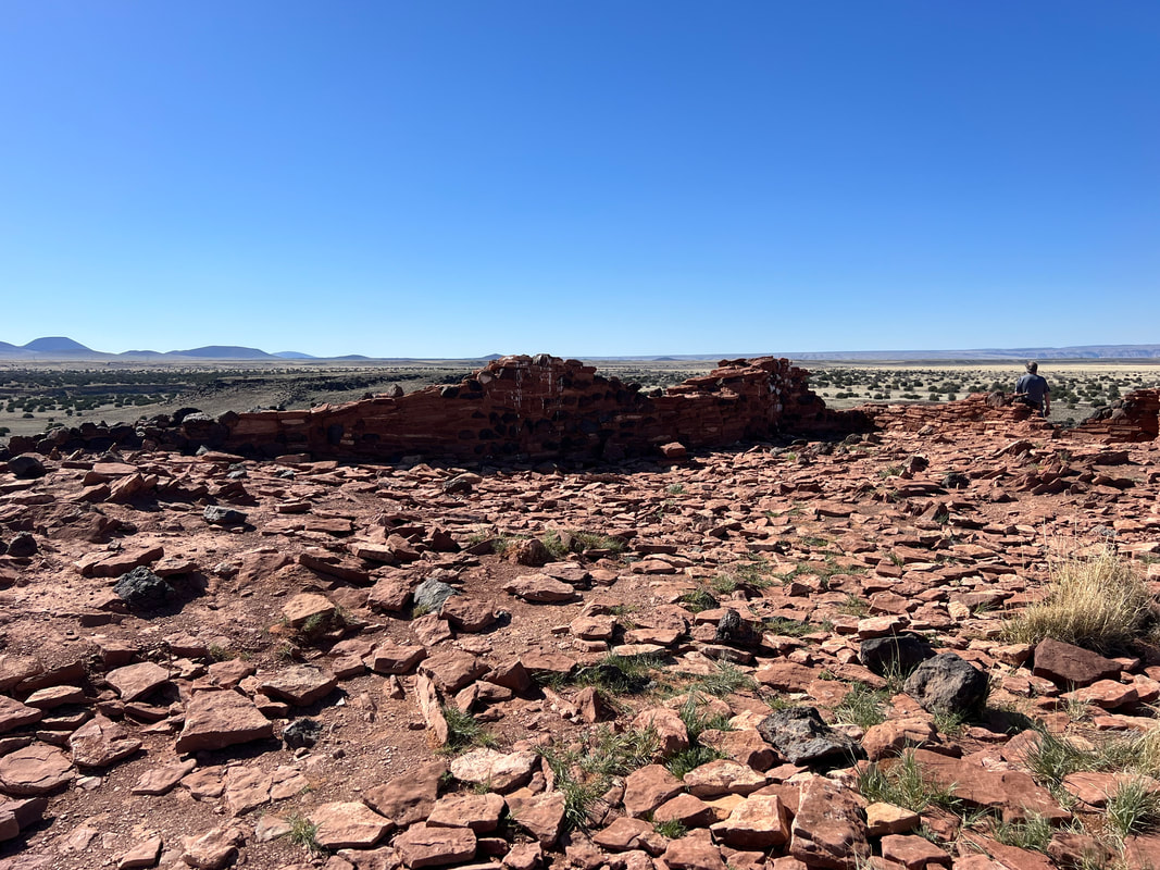
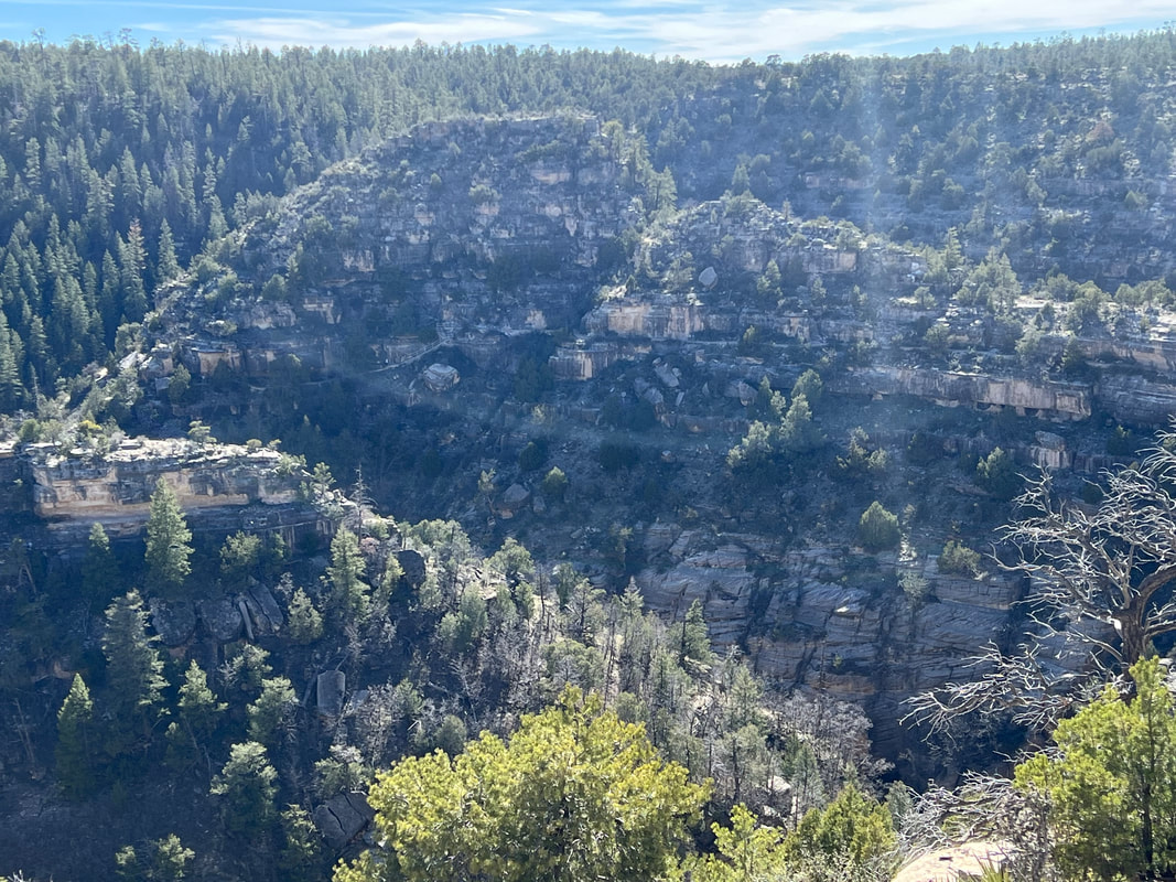
It’s apparently a well-kept secret that three beautiful and interesting National Monuments are within about 100 miles of the Grand Canyon’s South Rim. Thanks to Tom’s diligence and the National Parks app, we figured out that these three National Monuments are all in a line, and basically on the way to the Petrified Forest National Park. We made it to Wupatki National Monument the same day as we left the Grand Canyon, and managed to see four of the five partially reconstructed dwellings of the ancient puebloan people. The dwellings are scattered throughout the area, but the park service has reconstructed four areas representing different uses of the structures when they were inhabited. We didn’t see more than three or four people at any of the sites, and all of the sites had clean restrooms and adequate garbage collection, which was a nice change after the Grand Canyon. The largest reconstructed area is at the Visitors’ Center, so while we were there we asked about boondocking options. This National Monument and the Sunset Crater National Monument are surrounded by the Coconino National Forest, and the rangers gave us directions to get to a site outside the National Monument boundaries in the National Forest. It was beautiful! We were only about a mile off the paved road on a very well maintained gravel road, but it was completely quiet and we didn’t see another soul while we were there. And, roads and trails wind all through the National Forest, so we were able to take the dogs for a nice walk in the morning before leaving to see the last of the Wupatki structures and the other two National Monuments. After visiting the last Wupatki site, we moved on to Sunset Crater National Monument. Many of the trails in that area are closed because a massive wildfire blew through there almost exactly a year ago, and some of the areas are not yet safe due to the potential of falling trees. The National Monument is the area surrounding the Sunset Crater, which is a dormant volcano, and the main attraction is the still clearly visible lava fields where NASA trained the moon-walking astronauts in the 1970s. After climbing an active volcano in Guatemala a few years ago, Tom and I were ready to not be super impressed, but we were pleasantly surprised to find it very interesting since the interpretive signage explained all of the different forms in the lava beds. From Sunset Crater, it was only about a half hour’s drive to Walnut Canyon National Monument. Walnut Canyon is more dwellings of ancient peoples, this time in the cliffs of the canyon. The park service has done a great job of running a very accessible trail around an “island,” which is really the cliffs in the middle of an oxbow. The trail highlights some of the dwellings, as well as plant and animal life and geological features. This was probably our favorite of the three National Monuments, although we would have been happier to have not been there on a school day when multiple school groups with hordes of yelling children invaded the place. But, we managed to get ourselves on the trail between the groups, so it was a very enjoyable visit. Our original plan had been to leave Walnut Canyon and get to some BLM land immediately outside the Petrified Forest National Park. However, we didn’t finish at Walnut Canyon until almost 4pm, so we modified our plans and headed for the Visitors’ Center in Winslow, Arizona.
0 Comments
We left Kingman Wash and followed directions to the Grand Canyon’s South Rim in Arizona. All other entrances to the park are closed, and will be until the beginning of June, but the weather at the South Rim was beautiful with sun and temperatures in the 60s. While we could still see patches of snow in the pines, the ground was generally clear. As we got closer to the park we started to see more traffic, and when we reached the park entrance, we found ourselves in a five-lane wide line with a 20 minute wait to get to the booth to either pay or show your card to enter the park. Both Tom and I had been really looking forward to seeing the Grand Canyon because I had never visited and Tom was about six when his parents took the family on a vacation there, but at this point we started to wonder if we were going to end up doing a drive by because there were too many people and we wouldn’t be able to park. We showed our card and finally made it through the gate and drove another four miles to the main parking lot by the Visitors’ Center. We were lucky; another RV pulled out of one of the limited RV parking spaces just as we were pulling in, so we snagged a spot. Regular cars had started stacking themselves in the RV spaces because the lot was so full, but thanks to Tom’s diplomacy we managed to share a space with a car and everybody was happy. The Visitors’ Center was closed, but we checked out a big map and decided to visit Mather Point and then take a walk on the Rim Trail. And then we started saying “Wow,” a lot. I knew the Grand Canyon was big, but I had no idea just how big until I saw it. The area around the Visitors’ Center was very crowded, but once we were about a half mile down the trail, the crowds thinned and the walk was actually very pleasant. However, we’re still not sure how that park is being managed. We didn’t see a single ranger or volunteer, and it was the dirtiest park we’ve visited so far. The bathrooms were filthy, garbage cans were few and far between so a lot of litter had been dropped on the ground, and regular trash was spilling out of recycling containers, which were more plentiful than regular garbage cans but still inadequate for the amount of people who were there. It doesn’t seem like it should be a surprise that this is a destination which will draw a lot of people, especially since it’s the only open park entrance, so we really couldn’t figure out why park management seemed so ill prepared for the crowds. We enjoyed our wander anyway, and decided to head to some BLM land south of the park for the night. The Kaibab National Forest surrounds the park, and stretches almost all the way back to Williams, which is about 40 miles south of the park entrance. As we started checking weather, we realized that going about 15 miles south and reducing our elevation would make the overnight temperatures about 10 degrees warmer. So, we headed south with the plan to come back in the morning to hike the Rim Trail and then head south and east on SR64. We found a very nice parking place in the Kaibab National Forest, and while the temperatures got below freezing, it didn’t get cold enough to freeze any water lines. We were glad we went back to see more of the canyon rim, since the walk west offered entirely different views than the previous day’s walk east. We then stopped at a few of the viewpoints along SR64, and stopped at the Desert View tower. This gave us even more different views before heading towards Wupatki National Monument. We had considered going to Sedona, but after our dismay with the crowds at the Grand Canyon, we decided to give it a pass and go to some of the lesser known parks before going to the Petrified Forest National Park.
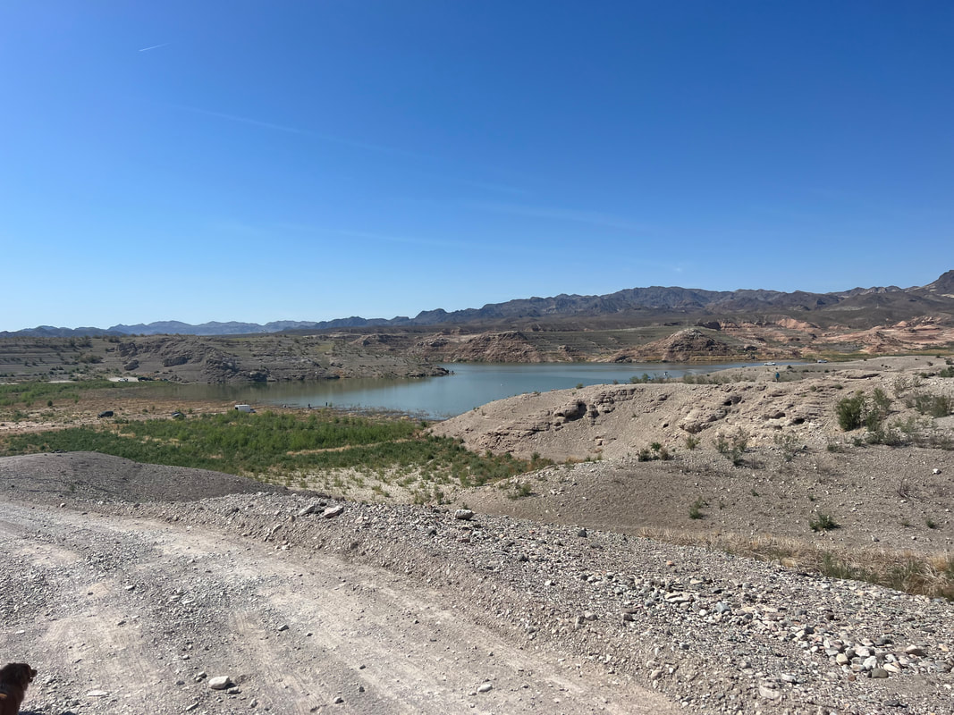
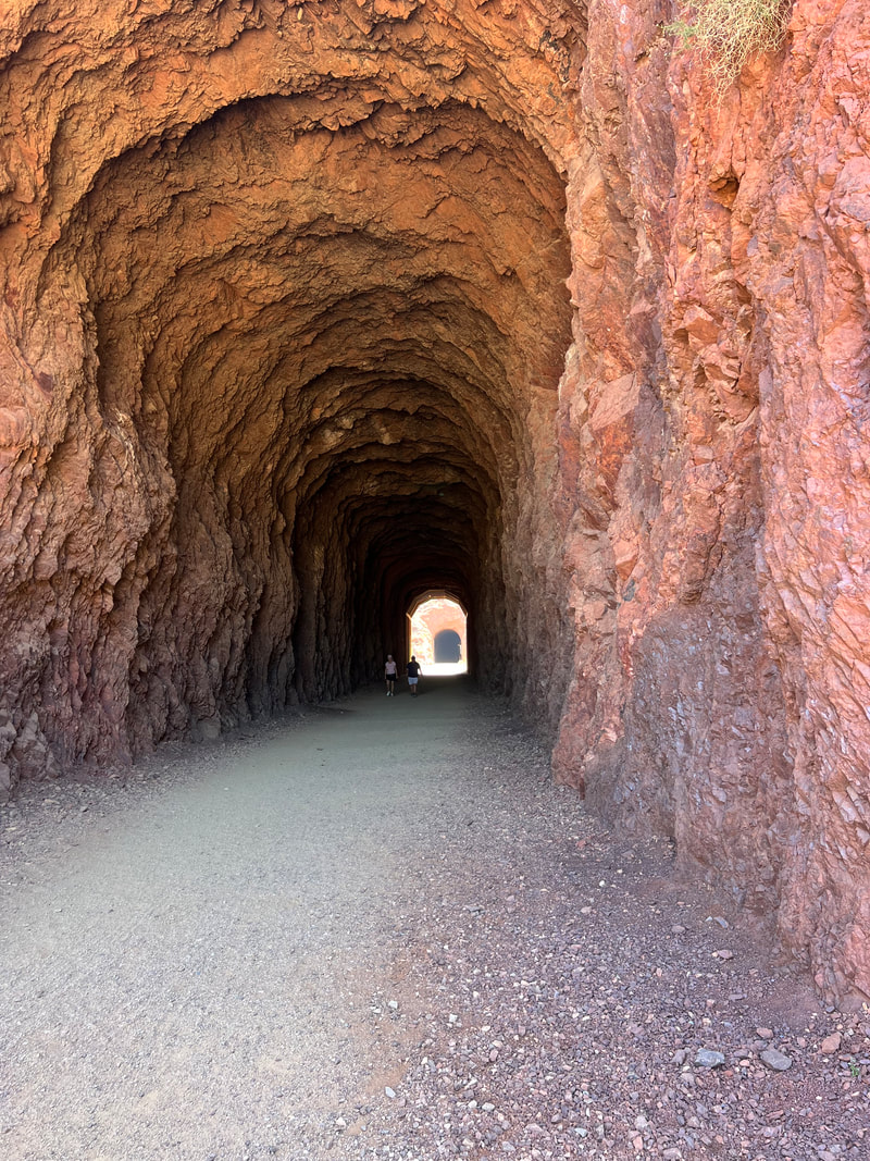
We left Las Vegas with the intention of heading to some BLM land near Hoover Dam, visiting the dam in the morning, and then continuing our drive east. We always run at least two GPS systems, usually Apple Maps and the TomTom trucker GPS. As we were leaving Las Vegas, we noticed that the two systems were not in agreement on where to go, but we were sort of fed up with the day and didn’t really investigate their differences, and decided to just follow the TomTom since that’s the system that keeps us out of trouble with the size of our rig. We eventually realized that the 40 minute drive had taken over an hour, and our arrival time was still about a half hour out. TomTom has led us astray in the past, and we usually resolve it by getting a map out and reading it ourselves, old school style, and then we figure out how to get where we want to go. This time, however, as we looked at where we were, we found out that TomTom hadn’t taken us where we’d asked, but to where we’d rather go. In our minds, Lake Mead and Hoover Dam were interchangeable. Of course we knew that Lake Mead is very large, and Hoover Dam is just in a relatively small spot where the river is dammed to create the lake, but in our heads, if we saw Hoover Dam, we’d see Lake Mead. Thanks to TomTom, we went to the Northshore Drive of Lake Mead, and not only found a better place to camp, but spent a whole day exploring the north shore of the lake. The Lake Mead National Recreation Area has a few developed campgrounds, but they also allow free disbursed camping. The ranger at the fee gate told us where to look for disbursed camping, and after filling our water tank at one of the developed campgrounds, we headed to Government Wash to park with a bunch of other campers and RVs overlooking the lake, or at least what remains of the lake. I’ve read a lot of news stories about how far the lake has receded, but it’s hard to believe the scope of it until you see it. When I looked at where we were on maps.me, which keeps its maps current for the most part, I noticed that we were camped in the water. So, the next day we took a walk around the area through what was lakebed not that long ago, and saw the boats in the middle of the desert where they either resurfaced after sinking, or were just trapped as the water receded and so sunk to lakebed level as the lake disappeared. It’s eerie to think about walking in an area where there would have been 200 feet of water over your head 20 years ago. The next day we drove 40 miles out Northshore Drive to the ruins of the St. Thomas village. St. Thomas was a thriving town, a railroad stop, and a trading post in the early 1900’s, but when the dam was built in the 1930’s, the residents were paid for their homes and properties and forced to relocate. Many of the residents actually moved their houses, although some buildings were made of rock or brick and could not be moved. When Lake Mead’s waters receded, the village was exposed, and you can walk through it and see partial buildings where they couldn’t be moved, and foundations where the houses were moved away. You can also see where the tree-lined streets were, with the stumps of the shade trees still sticking up out of the ground even after being under water for decades. It’s fascinating, and well worth the drive, although the drive may be worth it all on its own just for the constantly changing desert scenery with occasional glimpses of the lake. We spent another night at Government Wash, and left the next morning to hike the Historic Railroad Tunnel Trail, which is the rail bed for the trains that took all of the material needed to build the dam to the dam site. The trail goes through five huge tunnels, each over 25’ high, and cut through solid rock. Besides allowing you to appreciate a very impressive engineering feat, it’s a great trail to hike because it’s wide and flat and offers great views of the lake. After our hike, we started across the bridge towards Hoover Dam in our camper, only to find a sign before the bridge telling us that there was a high wind advisory and high profile vehicles were not recommended on the bridge. After a few bad wind experiences in the camper, that was enough to convince us to turn around and head back to the Lake Mead Visitors’ Center. Tom then had the brilliant idea that we could unload our e-bikes and bicycle along the entire Railroad Tunnel trail to the dam, and see it without having to worry about either the wind or parking at the dam. As I said before, the trail is fairly level and nicely graveled, so it’s ideal for bicycling, especially when you have pedal assist, and it’s only a little over 3 miles from the Visitors’ Center to the dam. We walked around over the dam and got the views from every direction before bicycling back to the camper. By the time we got back to the camper, the winds were manageable, and some guides at the dam said they hadn’t seen any campers or semis blow off the bridge, so we decided to make a run for Kingman Wash, which is less than 10 miles from the dam. That’s where we had planned to go when we left Las Vegas, and by that point we knew how to get there. What we didn’t realize from the online reviews was that the three miles to the official camping area by the lake is very difficult driving, even for a high clearance vehicle with 4WD. The road has lots of rocks sticking quite a bit out of the ground, and there are a few hills that look more like black diamond mogul runs at a ski area. We very slowly made our way about three quarters of a mile up the road, and pulled off at what looked to us like a campsite with a fire ring surrounded by hills which cut the wind. We had a peaceful night and decided to sit for another day until the winds died, so we took a walk. While we were on the road, a park ranger stopped us and told us that we technically weren’t allowed to park along the road, only in the designated camping area, but when we explained that we had pulled up because of the wind, and that even getting that far down the road had been difficult, he was very understanding and said that since it was a safety issue, and of course we were tired, we were more than welcome to spend another night there. We did our due diligence and walked the rest of the road down to the lake, more than willing to move if it seemed possible, but while the hike let us see some stunning scenery, the road didn’t get any better and we stayed put for another night. The next morning, the wind had stopped and we headed out of Nevada for the Grand Canyon.
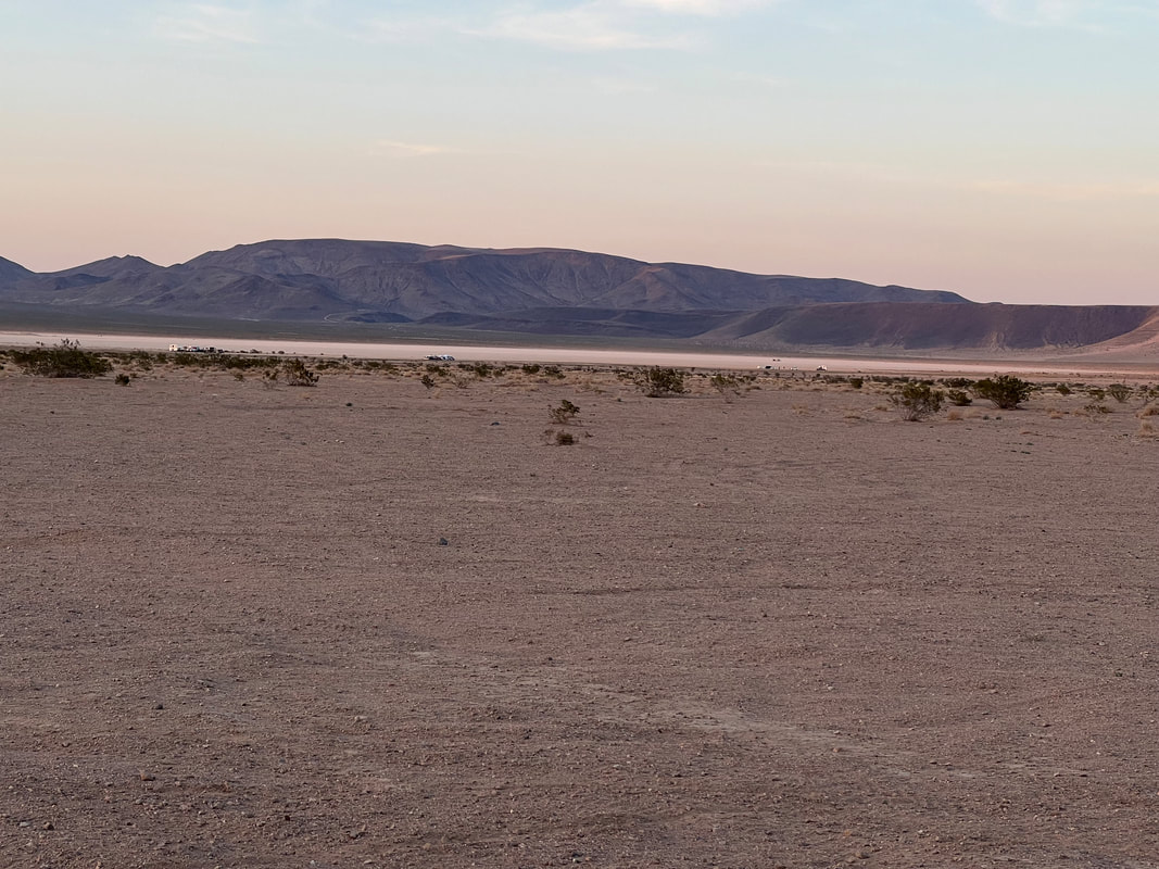
As we made our way through the pass on I-15 towards Las Vegas, we decided that we would stop at some BLM land called the Jean/Roach Dry Lake Recreation Area. It was easy to get to with a nicely graded dirt road off the paved road, and lots of places to park. Parking on the dry lakebed was an option, but we decided to head a little further in, away from the highway. After we parked, we took the dogs for a walk, and when we came back some people with motos were buzzing around our camper and we realized we had parked in the middle of an informal motocross track. Tom immediately called one of the riders over and told him that we would move, but he told us that we really weren’t in the way and they would be leaving shortly, which they did. We settled in for the evening, and around 8pm we heard loud thumping bass coming from the direction of the lakebed, and could see a line of lights where people were obviously meeting. We figured it was Friday night and the locals were having a party, and went inside to watch TV and go to bed. After we turned off the TV, we thought the music seemed a little louder, but decided it was just because there was no other noise around, and we both tried to go to sleep. However, neither of us managed to really get to sleep because we quickly realized that it wasn’t our imagination that the music was getting louder, and in addition to the thumping bass, we could hear the rest of the music track, as well as people yelling. Around 3am our aging brains realized that we’d managed to park at the edge of an all night techno rave, and we both kept listening to the music and wondering, as the noise paused between tracks, if it was over. We finally got up around 6:30, and the music didn’t stop until close to 9am. We took a wander towards the lake to see what a rave looks like, but by that time it was just a bunch of cars, a few people wandering around, and gigantic speakers in two U-Haul moving trucks which they were repositioning. We went back to the camper, showered, and got on the road before the next session could start. This is a video of the rave from our camper, so you can see how far away it is. We did this around 8pm, and you have to listen closely to hear the bass beat. We were really surprised how loud it was by morning. We left the recreation area and headed for Las Vegas. Neither of us has ever had any real desire to visit Vegas, but since we were so close we took a drive down the strip. That was enough for us, and it looks just like it looks in the movies. We saw lots of people, lots of traffic, lots of noise, lots of lights, and lots of Walgreens, which we haven’t figured out quite yet. We had zero desire to even try to park the truck, and after I took a few photos through the windshield we exited the north end of The Strip and headed for Tule Springs Fossil Beds National Monument. The Tule Springs Fossil Bed National Monument is probably the most disappointing National Park we’ve visited. We’d read lots about it, and it was all about how great it was that a meaningful National Park was just outside Las Vegas. This area is known for the density of fossils which have been being unearthed for over a century. All sorts of dinosaur bones and mammoth bones as well as fossils of smaller and lesser known creatures have been discovered here, and it is near the site of The Big Dig, a major archeological site. However, when you get to the park and start reading the informational signs, the signs tell you that all of the fossils are buried, and you aren’t allowed to dig, so you just have to imagine the thousands of fossils that are right underneath your feet. That’s great, but what you’re seeing is more desert like you’ve seen for hundreds of miles in each direction, and imagined fossils don’t really add anything to the appeal. The desert is beautiful, but if you’re going to a *fossil bed* it would be nice to actually see some fossils. After this realization we tried to go to The Big Dig, which is in a nearby state park, but it was closed. We decided to exit Las Vegas and head for Hoover Dam.
We left Larkspur and headed for Sacramento, the capital of California. This was an interesting jump for us, because after our minute planning for the San Francisco stop, we were heading for Sacramento with no idea where we were going from there. Our original plan - and I mean original, like from when we started thinking about this adventure - was to head north through California and into Oregon, then through Washington, and then up the coast through Canada to get to Alaska this summer. The planning, according to the calendar, was going perfectly. But - and this is a very big but - this year’s record snowpack in the mountains of California have caused our ability to exit California through the north, or even the northeast, to be very limited since even the major interstates, I-5 and I-80, are still requiring chains through the passes. Hugging the coast was a possibility, but we would have to bypass a lot of the parks we wanted to see. And, we have been regularly chatting with friends we are planning to visit in Portland, and they have been saying wait, wait, wait, because even in April, Portland is still experiencing winter weather which we just aren’t equipped for either physically or mentally. So, as we pulled into Sacramento, we were convincing ourselves that our best course of action was to head south as far as we had to go to start heading back east, with the revised plan to get to Alaska on a more eastern route, which would also give us the chance to pick up a few of the Mid Atlantic states we’d missed as we scurried south trying to stay ahead of the cold through last fall. Our unsettled mental state must have given us some bad juju, because as a capitol, Sacrament was a bust. It looks, from the windshield, like a beautiful capital district, with an imposing building and an expansive park. However, we’re not quite sure, because we drove every street within a mile of the capitol, and couldn’t find any parking for our oversized rig. The metered parking spaces lining the streets were all too narrow, so even though we would have happily paid for two spaces to accommodate our length, we would have been hanging in the street. We found an open parking lot and squeezed ourselves into a space, only to find a big “No RV Parking” sign at the kiosk where we went to pay. We considered paying the $10 for an hour anyway and hoping for the best, but decided that if Sacramento was our last stop in California, we’d rather not ruin it. So, we contented ourselves with the drive by photo we’d taken on our way in, and prepared to head south. After a quick scan of maps and mid-range weather reports, we decided that our best escape route was to head south until we could pick up I-15, which runs out of California between Death Valley to the north and the Mojave Desert Preserve to the south, and into Nevada and Las Vegas. That was way more ground than we could cover in one day, so we found an Army Corp of Engineers park called Hidden View Campground at Helmsley Lake near Madera, California. It was a great place to spend a quiet night, which we really appreciated after the urban RV park. Helmsley Lake was still more than a day’s drive to Las Vegas for us, so we spent one more night at Jawbone Canyon, which was only about 10 miles out of our way. We were hitting high winds and wanted to stop, and we knew we could take a paved road to easily accessible campsites, so it was only sensible. We were a little surprised when we got there on a Thursday and found it very busy, until we realized it was the end of the school vacation for lots of schools, and apparently it’s a thing to take the kids out to ride their motos and ATVs in the desert. We really enjoyed watching them race up and down the hills, but we were glad the wind had stopped in the morning so we could continue on to Las Vegas.
|
Meet the Moonracers
Tom and Marge are taking Moonracer Farm On The Road Again. Follow our journey to build an expedition vehicle and travel! Archives
January 2024
Categories |

