We left Las Vegas with the intention of heading to some BLM land near Hoover Dam, visiting the dam in the morning, and then continuing our drive east. We always run at least two GPS systems, usually Apple Maps and the TomTom trucker GPS. As we were leaving Las Vegas, we noticed that the two systems were not in agreement on where to go, but we were sort of fed up with the day and didn’t really investigate their differences, and decided to just follow the TomTom since that’s the system that keeps us out of trouble with the size of our rig. We eventually realized that the 40 minute drive had taken over an hour, and our arrival time was still about a half hour out. TomTom has led us astray in the past, and we usually resolve it by getting a map out and reading it ourselves, old school style, and then we figure out how to get where we want to go. This time, however, as we looked at where we were, we found out that TomTom hadn’t taken us where we’d asked, but to where we’d rather go.
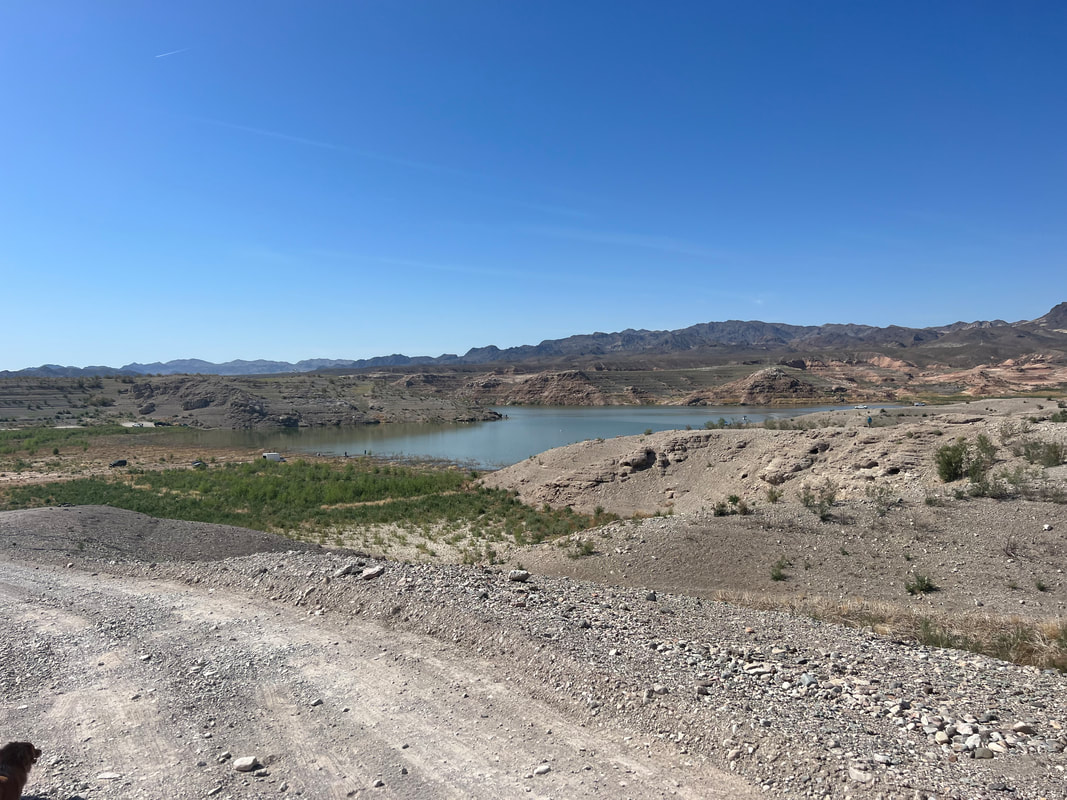
In our minds, Lake Mead and Hoover Dam were interchangeable. Of course we knew that Lake Mead is very large, and Hoover Dam is just in a relatively small spot where the river is dammed to create the lake, but in our heads, if we saw Hoover Dam, we’d see Lake Mead. Thanks to TomTom, we went to the Northshore Drive of Lake Mead, and not only found a better place to camp, but spent a whole day exploring the north shore of the lake. The Lake Mead National Recreation Area has a few developed campgrounds, but they also allow free disbursed camping. The ranger at the fee gate told us where to look for disbursed camping, and after filling our water tank at one of the developed campgrounds, we headed to Government Wash to park with a bunch of other campers and RVs overlooking the lake, or at least what remains of the lake.
I’ve read a lot of news stories about how far the lake has receded, but it’s hard to believe the scope of it until you see it. When I looked at where we were on maps.me, which keeps its maps current for the most part, I noticed that we were camped in the water. So, the next day we took a walk around the area through what was lakebed not that long ago, and saw the boats in the middle of the desert where they either resurfaced after sinking, or were just trapped as the water receded and so sunk to lakebed level as the lake disappeared. It’s eerie to think about walking in an area where there would have been 200 feet of water over your head 20 years ago.
The next day we drove 40 miles out Northshore Drive to the ruins of the St. Thomas village. St. Thomas was a thriving town, a railroad stop, and a trading post in the early 1900’s, but when the dam was built in the 1930’s, the residents were paid for their homes and properties and forced to relocate. Many of the residents actually moved their houses, although some buildings were made of rock or brick and could not be moved. When Lake Mead’s waters receded, the village was exposed, and you can walk through it and see partial buildings where they couldn’t be moved, and foundations where the houses were moved away. You can also see where the tree-lined streets were, with the stumps of the shade trees still sticking up out of the ground even after being under water for decades. It’s fascinating, and well worth the drive, although the drive may be worth it all on its own just for the constantly changing desert scenery with occasional glimpses of the lake.
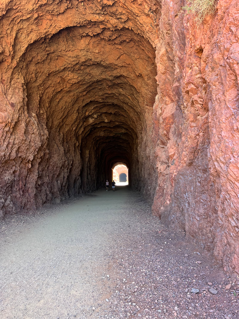
We spent another night at Government Wash, and left the next morning to hike the Historic Railroad Tunnel Trail, which is the rail bed for the trains that took all of the material needed to build the dam to the dam site. The trail goes through five huge tunnels, each over 25’ high, and cut through solid rock. Besides allowing you to appreciate a very impressive engineering feat, it’s a great trail to hike because it’s wide and flat and offers great views of the lake.
After our hike, we started across the bridge towards Hoover Dam in our camper, only to find a sign before the bridge telling us that there was a high wind advisory and high profile vehicles were not recommended on the bridge. After a few bad wind experiences in the camper, that was enough to convince us to turn around and head back to the Lake Mead Visitors’ Center. Tom then had the brilliant idea that we could unload our e-bikes and bicycle along the entire Railroad Tunnel trail to the dam, and see it without having to worry about either the wind or parking at the dam. As I said before, the trail is fairly level and nicely graveled, so it’s ideal for bicycling, especially when you have pedal assist, and it’s only a little over 3 miles from the Visitors’ Center to the dam. We walked around over the dam and got the views from every direction before bicycling back to the camper.
By the time we got back to the camper, the winds were manageable, and some guides at the dam said they hadn’t seen any campers or semis blow off the bridge, so we decided to make a run for Kingman Wash, which is less than 10 miles from the dam. That’s where we had planned to go when we left Las Vegas, and by that point we knew how to get there. What we didn’t realize from the online reviews was that the three miles to the official camping area by the lake is very difficult driving, even for a high clearance vehicle with 4WD. The road has lots of rocks sticking quite a bit out of the ground, and there are a few hills that look more like black diamond mogul runs at a ski area. We very slowly made our way about three quarters of a mile up the road, and pulled off at what looked to us like a campsite with a fire ring surrounded by hills which cut the wind. We had a peaceful night and decided to sit for another day until the winds died, so we took a walk. While we were on the road, a park ranger stopped us and told us that we technically weren’t allowed to park along the road, only in the designated camping area, but when we explained that we had pulled up because of the wind, and that even getting that far down the road had been difficult, he was very understanding and said that since it was a safety issue, and of course we were tired, we were more than welcome to spend another night there. We did our due diligence and walked the rest of the road down to the lake, more than willing to move if it seemed possible, but while the hike let us see some stunning scenery, the road didn’t get any better and we stayed put for another night.
The next morning, the wind had stopped and we headed out of Nevada for the Grand Canyon.


