|
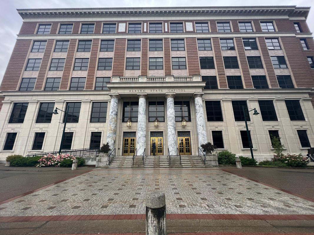
We pulled into Juneau early, but it was 9:00pm, so it was dark, as well as still raining. Based on iOverlander reviews, we parked at the West Glacier Trail trailhead. We weren’t too sure it was okay, but there were a couple of carloads of young people hanging out and partying, so Tom asked them if it was both legal to park there, and if we would be crashing their party. They assured us that it was legal and we wouldn’t be bothering them, so we took the dogs for a last walk and went to bed. It was still raining in the morning, so we decided not to hike the West Glacier Trail. We headed into Juneau with a stop at Safeway to shop. We left the “surburban” part of Juneau where all the shopping centers are, and took the highway to the downtown area near where the cruise ships come in so we could see the capitol building - our 42nd! We walked around the capital district for a couple of hours, and then went over to Douglas Island, where we went for a hike around the Treadwell mine ruins. We drove up to the Eaglecrest ski area, a city owned ski area, where RVs are allowed to park for the night. We were the only RV in the parking lot, surrounded by beautiful mountains and quiet. In the morning, we left the ski area and drove to the end of the highway on Douglas Island, where we saw more beautiful waterfalls, a bunch of bald eagles, and a golden eagle which looked like one of the dragons from Game of Thrones as it flew in front of us over the highway. We went back over the bridge into Juneau and stopped to see the humpback whale statue and fountain. After running a few errands, we went to the West Glacier trailhead of the Mendenhall glacier and hiked about 5 miles towards the glacier. We found that due to flooding we could not get all the way to the glacier, but it was still a beautiful hike. It was late afternoon by the time we got back to the truck, but with a few more hours of daylight we drove to the end of the road as far north as you can drive out of Juneau. There wasn’t much to see besides more beautiful scenery, so we turned around and stopped for the night at a pull out about halfway back to the ferry terminal where we had to be at 5 AM the following morning. We had taken the ferry to Juneau mostly because as Alaska’s capital, we had to visit it to check it off our capital list. However, we found ourselves charmed and fascinated with the state capital that can only be reached by air or water, but that manages to feel very much like a well run mid-sized American city. The city itself is in what looked to us like three distinct parts: the suburban shopping center interspersed with standard suburban neighborhoods, downtown with the cruise ship docks and government and business buildings, and Douglas Island, which is like another suburb but with small businesses instead of the big box stores. On all sides of this cloverleaf of a city, there is access to outdoor attractions, including fishing, hiking, skiing, rock climbing, and probably whatever else anyone may want to do out of doors. There are trailheads and small parks any direction you go, and from what we saw, the people of Juneau are using them. We had been a little worried that we wouldn’t like it because the downtown cruise ship port has to handle at least four or five cruise ships a day, but we found that most of the cruise people don’t go far from the ship, even in the downtown area, and the only downside we saw was that restaurant prices were exorbitant and we ditched our plan to have a seafood dinner. We had scheduled to be there only over the weekend, getting there Friday evening and leaving early Monday morning, and while we had initially been a little worried that we wouldn’t know what to do with ourselves, as we left we agreed that we could have spent at least a few more days enjoying Juneau and the surrounding area.
0 Comments
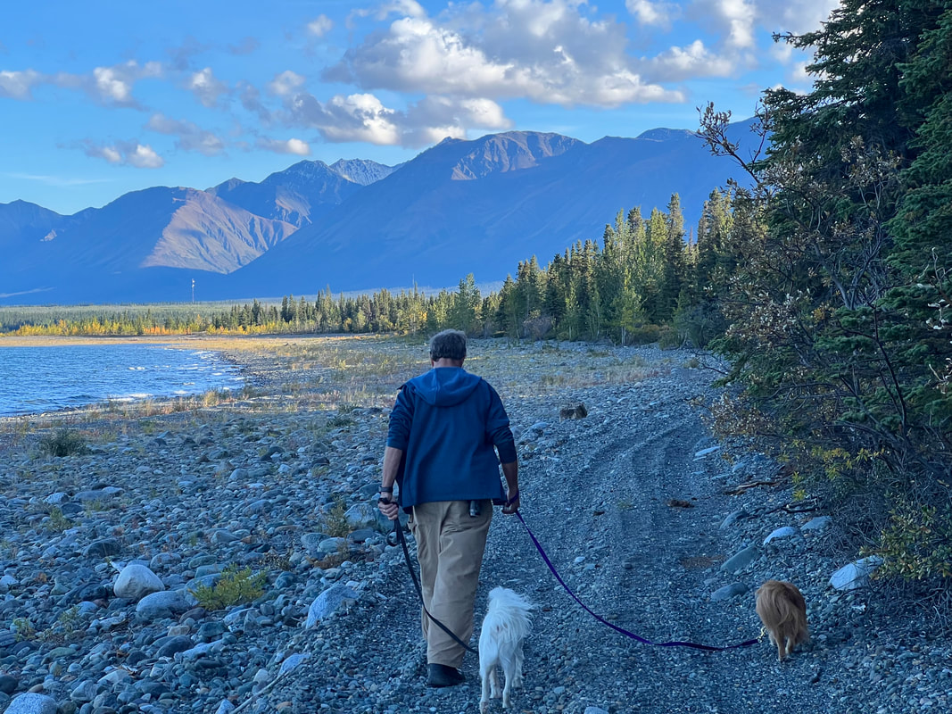
The morning we left the Wrangell-St. Elias NP, it wasn’t quite as cold as the previous morning, but it was raining, so we bagged our plan to walk the Caribou Creek Trail and headed out towards Tok. We stopped at the visitor center, and then made it to Tok by lunchtime, where we filled with fuel, filled with water at the gas station, then had lunch in the town visitor center parking lot before taking the dogs on a 4 mile plus walk on the walking trails through the town. The highlight of the walk was seeing a trailer pulling three decapitated bull moose heads, obviously heading for a taxidermist. We weren’t sure whether to be disgusted or impressed, but opted for impressed since right now moose hunting is THE THING in Alaska and as tourists, we need to accept it. We drove about 60 miles southeast of Tok on the Alaska Highway towards the Canadian border and stopped at a small, nice, and free campground on Yarger Lake. With us, 8 of 10 sites were full for the night, but it was very quiet with nary a generator to be heard. The next morning, we left Lakeview Campground and drove through lots of construction with pilot trucks to the small Seaton Recreational Area about 15 miles from the Alaska/Yukon border. There, we went for a short but pleasant hike through an area that has been reclaimed from being a construction staging area for the Alaska Highway and the Alaska Pipeline. We then drove on into Canada and drove on the very frost heaved Alaska Highway as far as Burwash Landing, which is about midway down Kluane Lake. We found another free campground on iOverlander, which was the weirdest so far since somebody is obviously doing a lot of work to make it nice, but it is totally abandoned and we were the only ones there. It’s right on a very large lake, and if it were summer and we had had kayaks and paddle boards we would have planned to spend a week there. Instead, we took the dogs for a couple of mile walk on a really nice trail along the lake shore, and settled in for a very quiet night. We left the free campground without seeing a single soul there, on the way in, or on the way out, and drove to the visitor center at Sheep Mountain. It was cold and windy, and we spent a couple of hours talking to people in the parking lot and trying to get excited about hiking the Sheep Mountain trail, which had been recommended by some people we met who live in Juneau. By the time we got done talking to people, the clouds had cleared, the wind had died, and we took a six mile walk around the base of the mountain to the river in our shirtsleeves. We saw lots of Dall sheep on the mountain, had some beautiful views, and while we didn’t see any bears, we saw a lot of bear tracks at the end of the trail (for us) by the river. We drove from Sheep Mountain through Haines Junction towards Kathleen Lake. We stopped at an iOverlander recommended pull off which is signed by the Yukon road department, and while we were right on the highway, we had a beautiful view up the creek through the valley. Traffic was less than a car every 10 minutes on the dead end road between Haines Junction and Haines, so we had a quiet night. We shared the space with one other truck camper, but we never even saw them. In the morning, it was raining, but we pulled on our new rain gear and drove to Kathleen Lake, where we hiked parts of a few trails before lunch, then drove to Haines. The weather was cloudy and cool, but the scenery was still stunning, both on the hikes and on the drive to Haines. With the hour setback coming from Canada into Alaska, we got to Haines a little before 6 and found a pull off just north of the ferry terminal. We were right on the water, and it was still cold and windy and rainy, but we were cozy in our camper. In the morning, we drove into Chilkoot SP to look for bears, but we only saw bald eagles. Then we went into Haines, where we walked around and saw the town and Ft. Seward. We went to a restaurant where I had the normal halibut fish fry, which was delicious, although Tom had it grilled instead of fried and he said it was dry. We stopped and talked to a gift shop owner, then went and checked in for the ferry to Juneau. We got all the paperwork done and had an hour to kill, so we went back to the park to look for bears, but there still weren’t any. We went back and got in line to load on the ferry, which went very smoothly and we left early. The ferry was very comfortable, and we spent the four and a half hour ride looking at scenery while it was still light and not too foggy, and then catching up on computer stuff.
We left the Little Tosina River CG in pouring rain after a sunny start, but by the time we got to the west entrance of the Wrangell-St. Elias NP, the sun was out again. We stopped there to get online and make ferry reservations to Juneau, and found that while we could get to Juneau whenever we wanted, we couldn’t get out until Monday, Sept. 11. We booked Haines to Juneau on Friday, Sept. 8, with a ferry out to Skagway on Monday, Sept. 11. This left us five days to get to Haines, so we decided to go in the north Nabesna Road entrance to the NP at Slana and camp and hike for a couple of days. The camping is free pretty much wherever we wanted to park, and hiking trails run everywhere off of the main road because one of the primary uses for the park is subsistence hunting for Alaska natives, so the entire park is super accessible. We went to the 10-site campground, which only had two sites open when we pulled in around 6pm, since we decided we’d rather be off the road. We took a walk down the road with the dogs when we got there, and were really glad we’d made the decision to see more of the park than the visitor center we’d seen on the west side before going to Valdez. The colors were already starting to change, and when you can look one direction and see blue sky and sunshine reflecting on the glaciers, and look the other and see lowering dark skies making everything look stark, it’s sort of hard to decide where to look…so we just wanted to see as much as possible. We could normally have driven another ten or so miles down the Nabesna road, but with all the rain there was a 2-foot gully with fast running water that we weren’t going to attempt to cross, by foot or by truck. We woke up Sunday morning to 25 degrees in the camper, with hard frost on the inside of the windows, and frost and iced puddles outside, although we didn’t take the thermometer out there. We had a little trouble getting the Buddy heater started after all summer in the closet, but it finally got going and with a little help from the electric heater and the gas stove, the inside temperature was up to 55 at 9am, which was tolerable, with the Buddy heater still running. We watched a number of tenters and van campers pack up, get in their warming vehicles, and drive off, but we stuck to our plan to head out for a hike, which ended up being two hikes, one in the morning and one in the afternoon. We had checked weather before we ran out of the cell zone and wherever it was coming from (supposedly Slana, which is only 28 miles north) said lows in the mid 30s, but either it was way off, or it’s just colder out by the glaciers. The next day we had planned to hike the Caribou Creek Trail, but although it was warmer than the previous morning, it was also raining. We ditched the plan to hike in the bush, and drove out of the park to start our multi-day journey to Haines to get the ferry to Juneau.
We left the decommissioned boat launch and stopped at the Wrangell-St. Elias Visitor Center to tour the buildings and take a short hike. We then headed towards Valdez, but the weather deteriorated to very windy, very rainy, and crap visibility, so we stopped at a gravel pit near Thompson Pass about 30 miles short of Valdez. According to iOverlander, we should have been able to see a number of glaciers from there, but it never cleared up. We took a walk along the river through the valley and got occasional glimpses of the mountains as the clouds parted, but mostly it was just cold and gray and wet. After leaving the very wet gravel pit the next morning, we drove through lots of rain and fog to Valdez, but had awesome views of waterfalls and mountains and glaciers anyway. We got into Valdez and hit the Safeway for cold relief supplies, and discovered that the very expensive American Theraflu is exactly the same as the much less expensive and equally effective Viro-Grip, which is almost gone from our brought from Belize pharmaceutical supplies. We headed out to the waterfront and walked along the harbor and through a small park with a peak for 360 degree views, and then went to one of the food trucks for the best fish tacos we’ve had in a long time, although the fish was halibut which probably wouldn’t be appearing in Mexican fish tacos. We headed out of Valdez and went to the Solomon Gulch Hatchery, where we saw the process of an “ocean ranch,” where the adult salmon are released into the wild where they can be wild caught, but they always return to the hatchery where they were spawned so their eggs and milt can be harvested. In addition to lots of salmon at all stages in their journey up the fish ladder and the stream, we also saw lots of sea lions, some otters, and a few seals, but alas, no bears. We left Valdez to partially clearing skies which revealed more and more amazing views, and stopped at the Worthington Glacier for a look before heading to a decommissioned campground on the Little Tosina River at MP65, where we were joined by only one other camper on Labor Day weekend Friday night despite having seen lines of RVs and campers heading into Valdez.
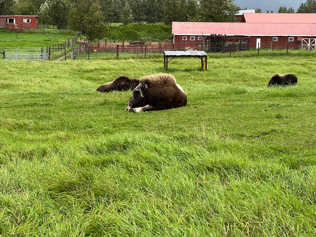
We drove back into Anchorage and back into our parking spot on the street at the end of Wayne & Marilyn’s driveway. We had planned on just spending one more night in their driveway, but we were again having too much fun. Shortly after we got there, Wayne took us out for more bird watching, and to see if we could see the belugas. We didn’t see any belugas, but we saw lots more birds, as well as a harbor seal where there usually aren’t any seals. The next day, Wayne was super kind and patient and drove us all around Anchorage doing errands. We spent hours in REI buying new rain gear and new binoculars, got our propane tanks filled, went to the post office, and went to Costco for chia. We also did more “urban” birding, had a bunch of exotic adult beverages, and talked a lot over excellent meals. Wayne again went above and beyond the next morning and took us downtown so Tom could renew our America the Beautiful Access Pass, and I could pick up some local gifts. We then sadly left them and got fuel and went food shopping before heading for Palmer where we went to the Musk Ox Farm to see the musk ox and get some qiviut. We thought we might make it a little further towards Glennallen, but between rain and the fact that we still needed to take a walk, we backtracked a few miles and got permission to park at the Palmer Visitor Center for the night, where we had access to the Rail Trail for a walk. The police in Palmer were polite enough to wait until 8:30AM to tell us we actually weren’t allowed to camp where we had camped the last night, but it didn’t matter because we had planned to head for Glennallen and Valdez that day anyway. We drove the very scenic Glenn Highway, and saw glaciers despite the rain and fog. We took a hike in Glennallen on a community nature trail, very cleverly signed by the local school’s science classes, so besides having a nice walk in the woods we learned a few things. We then drove about 10 minutes south of Glennallen to a paved lot that used to be a lot for a boat launch, although the river access is now closed, which is fine for campers since it leaves more room in the paved lot for campers. It wasn’t the nicest parking spot ever, but it was quiet and put us in a good spot to head for Valdez the next day.
|
Meet the Moonracers
Tom and Marge are taking Moonracer Farm On The Road Again. Follow our journey to build an expedition vehicle and travel! Archives
January 2024
Categories |


