|
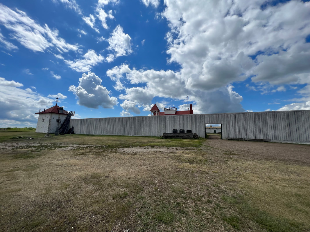
We drove from the Summit Campground south of the North Unit of the Theodore Roosevelt National Park to the Fort Union Trading Post National Historic Site, which straddles the North Dakota/Montana border. It’s a small site and isn’t much more than the partially reconstructed fort, but it was good for a walk with the dogs, since dogs were allowed everywhere, even in the fort. The mosquitos were again a major annoyance, so we left the fort and drove back into North Dakota to see the confluence of the Yellowstone and Missouri Rivers. The state has a very nice visitor center with a partially paved trail and lots of informational signs, but the mosquitos were also really bad at that site, and you couldn’t really see the actual confluence because of the trees, so after reading signs about how various members of the Louis & Clark party abandoned the group at that point because of the mosquitos, we got back in the truck to head into Montana. After some hit and miss campsites through North Dakota, we were pleased to find that Montana has tons of free to cheap places to camp. On the eastern side of the state, these are mostly fishing access sites along the river. The first one we found was Matthews Recreation Area, which actually has a camp host who is in the only official campsite. He told us to park wherever we wanted, so we pulled into a big field and watched a beautiful sunset over the Yellowstone River. We also walked along the river and found a gopher snake, which made us glad we’d decided to park in the field rather than one of the riverside spots. We left Matthews RA early the next morning because high winds were predicted from midday through the afternoon, so we were parked at the Bighorn Battlefield National Historical Monument in time for breakfast before attempting to tour the site.
0 Comments
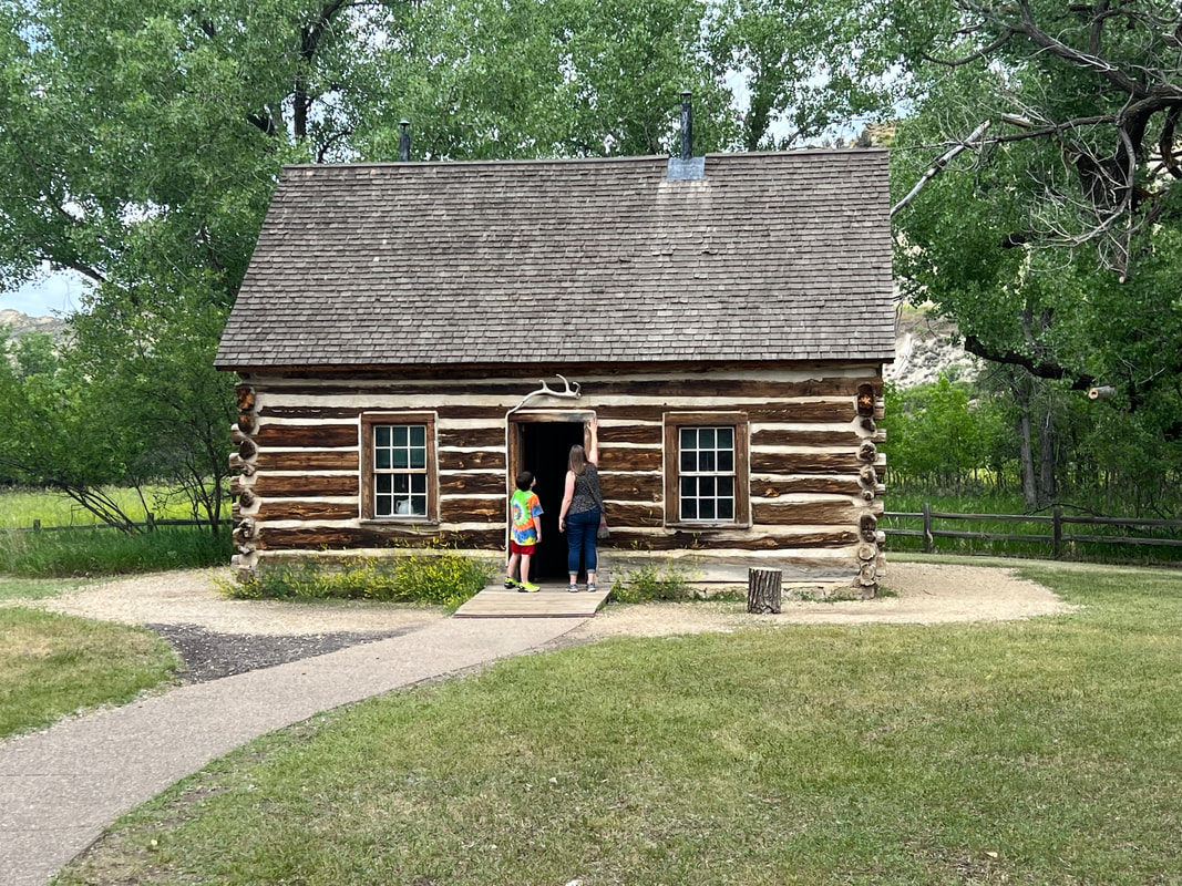
The tuning process on the truck requires plugging the OBDII (On Board Diagnostics II) into the truck port, then connecting that to his computer, then getting online so the tuner, who is in Missouri, can remote in to his desktop and drive the OBD. We didn’t have enough cell reception at the campground, so we stopped in Richardton so the tuner, Garrison, could install what he’d done based on the data he downloaded when I was grocery shopping. I took the dogs for a walk through Richardton from one end of the sidewalk to the other, and found the number of closed businesses depressing. I don’t know if it’s post covid situation, or if the economy in rural North Dakota is just really bad. The highlight of my walk was going by the fire department, where they were doing a program for local children, and I got to see Smoky the Bear in real life. This may not seem like a big deal, except that when I was a kid I didn’t have any posters in my room of whatever the popular teen crush was, just a poster of Smoky the Bear which I may still have packed away in a box somewhere. Grown up me knows it was just a man in a bear suit with pants and boots and a hat, but it still made me smile. While I was walking, Tom and Garrison got the truck set so it was ready for a road test, so we got back on the highway and headed for Theodore Roosevelt National Park. This park is at the very west side of North Dakota, and has three units: North Unit, South Unit, and Elkhorn Ranch Unit. We didn’t go to the Elkhorn Ranch Unit because it involves hours of travel on dirt roads, but we visited both the North and South Units. We started at the Painted Canyon Visitor Center, which is a rest stop off the highway and offers some vistas of the Badlands. We then went to the main visitor center for the South Unit in Medora, which is the base for the scenic road that is supposed to loop through the park, although at the moment it’s an out and back since they’re still working on fixing a culvert that washed out over the winter. We drove the out and back road, stopping to see the sights along the way. We left the park and drove to some Little Missouri River National Grassland land with dispersed camping sites. We parked on the edge of a bluff, which it turned out we were lucky to get since most of the sites filled up before dark. In the morning, we continued down the dirt road through the National Grassland and past some ranches to the trailhead for the Petrified Forest area. A 3 mile out and back trail winds through the badlands to a basin with a lot of petrified wood. Unlike the Petrified Forest National Park in Arizona, this area has very few logs, but has many stumps. We also saw bison on the way in, which were the first wildlife we had seen other than prairie dogs. We left the Petrified Forest area and drove to the North Unit. It’s supposed to be a straight shot up SR85, but a culvert is also out on that road, so we had to take a detour which probably added 20 miles on dirt roads to the trip, but which was still better than the way the park service was suggesting we go. The North Unit is smaller than the South Unit, with a 14-mile road running from east to west through the park. We drove that road out and back, stopping to see highlights along the way. We left the park and drove to the Summit Campground, another free National Grasslands campground just south of the park. This campground was sort of strange, because it’s just three parking places along a little dirt road that loops off of SR85. Each parking place has a ramada and a fire ring, but the campground is only about 200 yards from the highway, and you can see and hear the vehicles whizzing by on the other side of the grass. We also found a lot of garbage strewn on the ground, and while it wasn’t as bad as the place in New Mexico where we found the dead dog, we wouldn’t have wanted to spend more than a night there.
It didn’t ultimately matter, but throughout our time at the TRNP, we were always a little out of sorts. We had crossed into the Mountain Time Zone just before reaching the Schnell Recreation Area, and my watch had switched, but Tom’s hadn’t. The North Unit of the park is right on the line between Central Time and Mountain Time, which made Tom’s watch right again, but mine kept switching back and forth. The Summit Campground is technically in Mountain Time, but both of our watches kept switching back and forth there. It didn’t matter because we didn’t have anyplace we had to be at a specific time, but we spent the whole time we were in the area not really knowing what time it was. We ended up leaving for our next stop, the Fort Union Trading Post National Historic Site, an hour earlier than intended since we were heading back into Central Time until we crossed into Mountain Time in Montana. The Fort Union Trading Post also straddles the states and the time zones, so our watches endured another few hours of confusion. When we were at the Bismarck capitol, we saw a statue and an informational sign about Sakakawea, also known as Sakajawea, the Indian woman who traveled with the Lewis & Clark expedition as a guide, and who is also featured on one of the US dollar coins. We learned that the village where she lived is only about an hour north of Bismarck, and the Knife River Indian Villages National Historical Site commemorates her, as well as the Indian way of life in the area. Since we had time to kill and we knew our car part wouldn’t be delivered on Sunday, we headed to the park. The park is an archeological site which encompasses the village where Sakakawea lived, and two other Indian villages along the Knife River, which runs into the Missouri River. Lewis and Clark found Sakakwea and her husband, a trader they wanted in their party, because they were following the Missouri and the rivers that run into the Missouri. The museum has an information film which explains how the villages along the Knife River worked, as well as a trail that runs from the Visitor Center to the river and goes through two of the three villages, where you can still see the hollows that used to be the mound houses of the village. Nothing remains except some pockmarked ground and artifacts in the museum which were excavated from the area, but between walking the grounds and investigating the information in the museum, you can get a pretty good idea of how the Indians lived. The story of Sakakawea is also interesting , because the Lewis and Clark party wanted her husband’s expertise as a French trader, but found that her knowledge of the land and its people was much more valuable. We explored the site, then went to another city park - a small city, and a small park - in Stanton, ND. We parked on a primitive spot, which was just a spot of grass, but it was peaceful and quiet. In the morning, we walked around the town and then headed back towards Bismarck to pick up our car part. On the way, we found an unexpected landmark - the geographical center of North America. We didn’t even know that was a thing, and we only drove by it because we were heading back to General Sibley Campground to pick up the car part, and we wanted to go a different way than the way we had gone on the way to the Knife River Indian Village NHS. It is only as rock and a monument in the middle of a field, but it was a fun find. Just after we left the Center of North America, Martha from the campground called to say that the part had been delivered. We drove directly to the campground to pick it up. Our original intention had been to head directly from Bismarck to the Theodore Roosevelt National Park, but since we’d blown most of the day anyway, we decided to make the rest of the day a work day. Tom found a place that could squeeze the truck in - literally, through their exactly 12’ door - for an oil change, and then we went grocery shopping. While I was shopping, Tom called the tuner who had sent us the part and started the ongoing process of tuning the truck with the new turbo. It was after 4pm before we pulled out of Bismarck, and we headed west on I-94. We’d found the Schnell Recreation Area, a BLM free campground in the town of Richardton, on iOverlander, so we set the GPS to take us there. Our trucker GPS couldn’t find the address, so we relied on Apple, which only directed us to one underpass without suitable clearance, but we went back to the highway and approached from the other direction through town, and found it without any problems. This campground had enormous campsites with potable water, so we spent the night using water with abandon. In the morning, we drove out towards the national park, with a stop in Richardton to work on the truck.
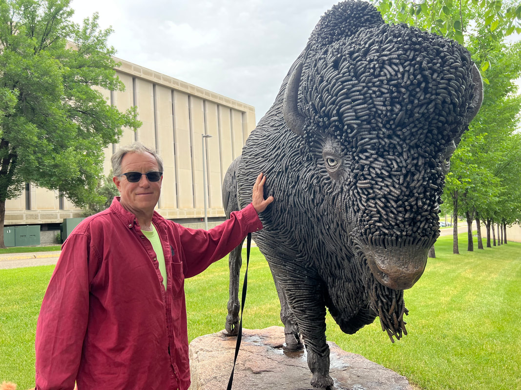
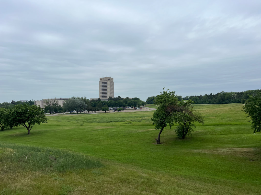
Ever since we’d left Versailles, MO, with the new turbo on the truck, we had both been very carefully monitoring the truck’s performance. Bruce had warned us that some things would be different, and said to work with it for a little while and see what we liked and what we didn’t. While we liked that we weren’t getting metal on metal scraping sounds when the turbo kicked on, we didn’t like that our fuel mileage had been cut from about 10mpg to about 7.5mpg. We also didn’t like the amount of black smoke coming from the tailpipe, which seemed tolerable at first but seemed much worse when we started driving higher speeds. Bruce had been trying to get Tom and the guy who had tuned the truck together on the phone, and Tom and David finally managed to connect as we were driving from Pierre to Bismarck. David explained that he’d tuned the truck as optimally as possible so that we’d have enough power to get through the mountains, and that if we wanted to improve the mileage and exhaust output, we would probably have to get a smaller turbo unit. This didn’t mean that the whole 4-day multi thousand dollar work would have to be redone, just that the top part would need to be replaced. Tom immediately called Bruce to ask about our options. Bruce called back about an hour later and told Tom that his recommendation was that we try working with a more experienced tuner, who thought that the turbo unit that was installed was fine, and that with a little time and finesse he could get our truck running in a way that would make us happy. The good news here was that we didn’t have to buy any new parts, and the tuning could be done remotely using an engine tuner computer which could be sent to us. The obvious place to send it was wherever we were going in Bismarck, but we didn’t know where that was. So, we started making phone calls to figure out where we could receive a small package. I don’t know if you’ve tried to reach a real live person on a phone recently, but we found that it’s basically impossible if you’re calling UPS, USPS, FedEx, or any other place that might be able to receive packages. The phone is answered by a bot who wants your tracking number, and if you don’t have a tracking number, you’re screwed. I finally started looking at campgrounds around Bismarck, and found a Bismarck city park with a phone number, and the phone was answered by a real live very nice person named Andrea, who immediately understood our problem and took my number so she could talk to her supervisor at General Sibley Park. She called me back about five minutes later - she really was a rock star, since I totally don’t expect callbacks anymore - and said they’d be happy to accept our package, and even gave me their address so we could call and give it to Bruce before making a reservation with them. I did that, then got on line and booked a campsite for the night, although Andrea had told me that they were wide open for that Thursday night, but they were full for the weekend. We hoped the part would be there sooner rather than later so didn’t really want to book for the whole weekend anyway, so that was fine. We found the park, and when Tom went to the office Andrea had our tag all ready from my online booking. She asked if we wanted a spot for the next night if any opened up, and since we figured it was doubtful that the computer thingie would make it from Missouri to North Dakota overnight, we said yes. We had barely had time to park when she called and said they’d had a cancellation, so we booked one more night in a different spot, which wasn’t a big deal since our plan was to drive the camper into Bismarck in the morning to see the capitol. That’s exactly what we did. The campground is only about 10 minutes from the capitol, and, like Pierre, the city of Bismarck itself is very small. The capitol is on a 100+ acre campus, and the city is a lot of not-too-fancy housing which includes a lot of multi-family buildings, which runs out to your typical suburban shopping options. While the capitol itself looks like a typical smallish high rise office building and is in no way memorable, the surrounding area was enough for us to take the dogs for a 4+ mile walk without much recrossing our tracks. I really enjoyed walking around the campus. We walked past the governor’s home, which can’t be called a mansion as it is in so many cities. The state museum takes up its fair share of space, along with all the typical memorials, but the bulk of the campus is prairie, which I found charming and interesting, while Tom thought it was a good excuse to not have to maintain a lawn. The thing we both found most educational and memorable was that they have preserved a train car from when France sent gifts to the US after WWII. The gifts were for the people, from the people of France, and weren’t anything memorable, except that they were memorable because they were from the people: embroidery, favorite perfumes, drawings from children, and everyday things that mattered to the people of France that they thought their US counterparts would appreciate post-war. It was somewhat heartbreaking in its simplicity. The other notable thing about this capitol was that we did not see any security. We saw police and security vehicles, but nobody was inside them. We have no doubt we were in view of cameras the entire time we were on the campus, but we never saw security personnel. Lots of people were walking on the paths, and the paths cover a lot of ground. It seemed to us that North Dakota feels pretty safe and secure. We left the capitol area and went back to General Sibley Park. We parked in our new campsite, and checked a couple of times during the afternoon to see if our package had arrived. It didn’t, so we took advantage of the very nice walking trails around the park. The campground is fairly large, with over 100 campsites. However, it is spread out over more than a half mile, with multiple loops. The campsites are all on the outside of the loops, so no matter where you park, you have park in front of and behind you. At the end of the day, when the package still hadn’t arrived, we asked if they got Saturday deliveries. Martha, the manager, said they do, so we planned to move out of our campsite at checkout time and go to the day use area. We spent the next afternoon doing some more walking, and catching up on computer stuff since we both had decent cell reception. The package did not arrive on Saturday, so we talked to the office and arranged to leave on Sunday, but come back on Monday to pick it up. Everyone in the office was very sympathetic to our plight, so we made plans to head to the Knife River Indian Villages National Historical Site on Sunday, after reading about that area and the history of Sakakawea at the Capitol.
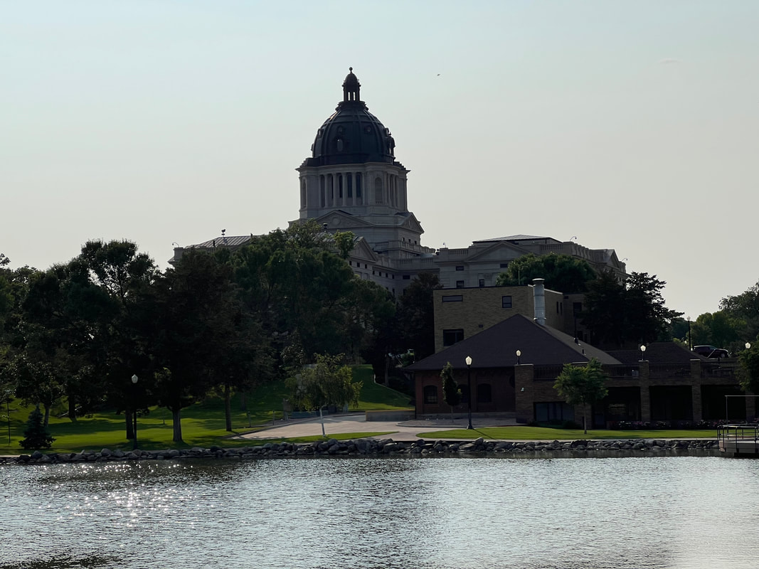
After spending the night at the Walmart in Wahpeton, ND, we made the decision to head south and check Pierre off the capital list. We still plan to hit a few parks in South Dakota on our way south, but the parks to Pierre would be about six extra hours of driving, where going to Pierre “on the way” to Bismarck only added a few hours. We cut the corner on North Dakota and made our way southeast through South Dakota on very flat, very straight roads. As we approached Pierre, the landscape became a little more interesting, with a few rolling hills and some horse farms, and we were surprised when the GPS told us we were less than 2 miles from the capitol and we were still in horse country. We had set the GPS for Griffin Park, which supposedly had a small campground. We had a little scare getting there because we were rerouted for some construction and passed a sign saying we were approaching a 11’6” bridge which we wouldn’t squeeze under, but after stopping and talking to residents and consulting maps, we found a route that would get us to the park without going near the low overhead bridge. The park does in fact have a very nice campground, although all of the RV sites were taken because a circus was coming to town and the circus people, as well as some of the construction people, were staying at the campground. That turned out to be a good thing, because we were able to park at the adjacent marina in the boat launch area, and it was free. We set up the camper, and were able to walk to the capitol, which was only about a half mile from the park. We had set the GPS for Griffin Park, which supposedly had a small campground. We had a little scare getting there because we were rerouted for some construction and passed a sign saying we were approaching a 11’6” bridge which we wouldn’t squeeze under, but after stopping and talking to residents and consulting maps, we found a route that would get us to the park without going near the low overhead bridge. The park does in fact have a very nice campground, although all of the RV sites were taken because a circus was coming to town and the circus people, as well as some of the construction people, were staying at the campground. That turned out to be a good thing, because we were able to park at the adjacent marina in the boat launch area, and it was free. We set up the camper, and were able to walk to the capitol, which was only about a half mile from the park. While Pierre isn’t much of a city, the capitol area is beautiful. It is surrounded by park, and the lawn runs down to a large lake fed by a hot spring which is 92 degrees all year. The small downtown area is wedged between the capitol and the river, along with some ball fields and parks, and the park like area behind the capitol runs all the way out into the countryside, which is the direction we had approached from and which is why we couldn’t figure out why we were almost to the capitol and we were still passing horse farms. Paths run all around the area, and we were able to successfully find our way back to the campground by an equally pleasant route, unlike our experience in St. Paul. In the morning, we followed the river walk path up the river for a few miles, and it was park almost the entire way. We passed picnic areas, a skate park, fishing docks, benches where you could sit and watch the geese, tennis courts, ball fields, kite fliers, and even the area where the circus was getting organized. I commented to Tom that if I had to pick one state capital to live in, I would pick Pierre because it doesn’t feel like a city and it’s very beautiful, and everyone we met was gracious. Tom reminded me that I probably wouldn’t like the South Dakota winters, which is true, but while this capitol wasn’t the most impressive, it definitely scored big points on just feeling good. We walked back to the marina, packed up the camper, and headed almost directly north towards Bismarck.
|
Meet the Moonracers
Tom and Marge are taking Moonracer Farm On The Road Again. Follow our journey to build an expedition vehicle and travel! Archives
January 2024
Categories |
