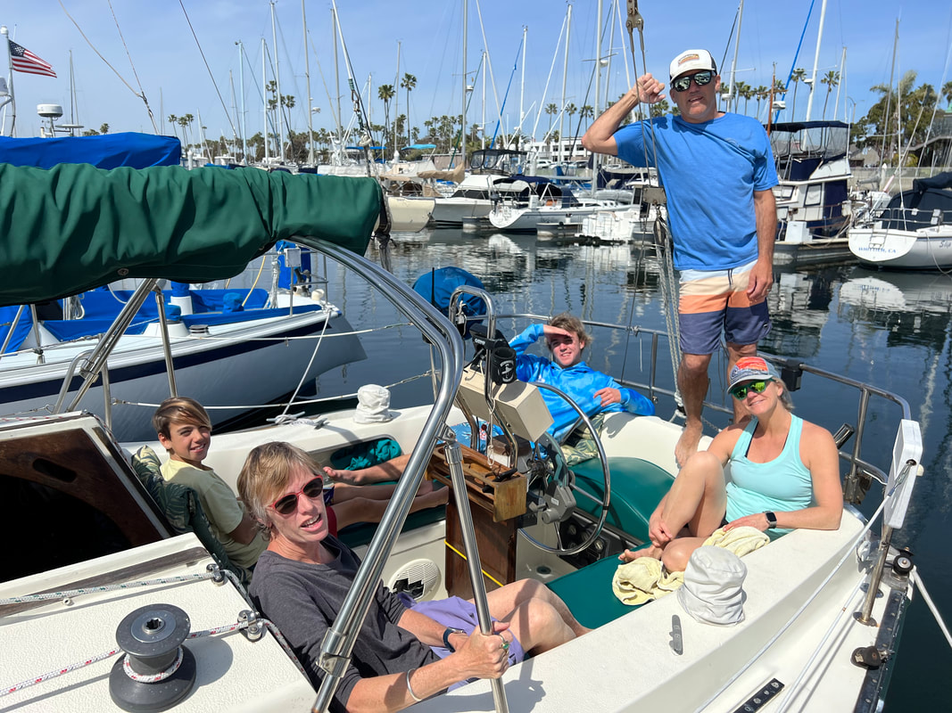
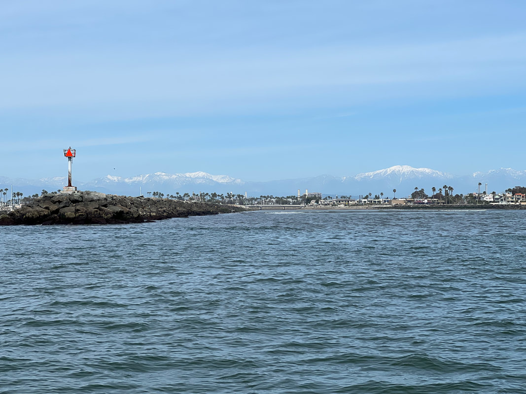
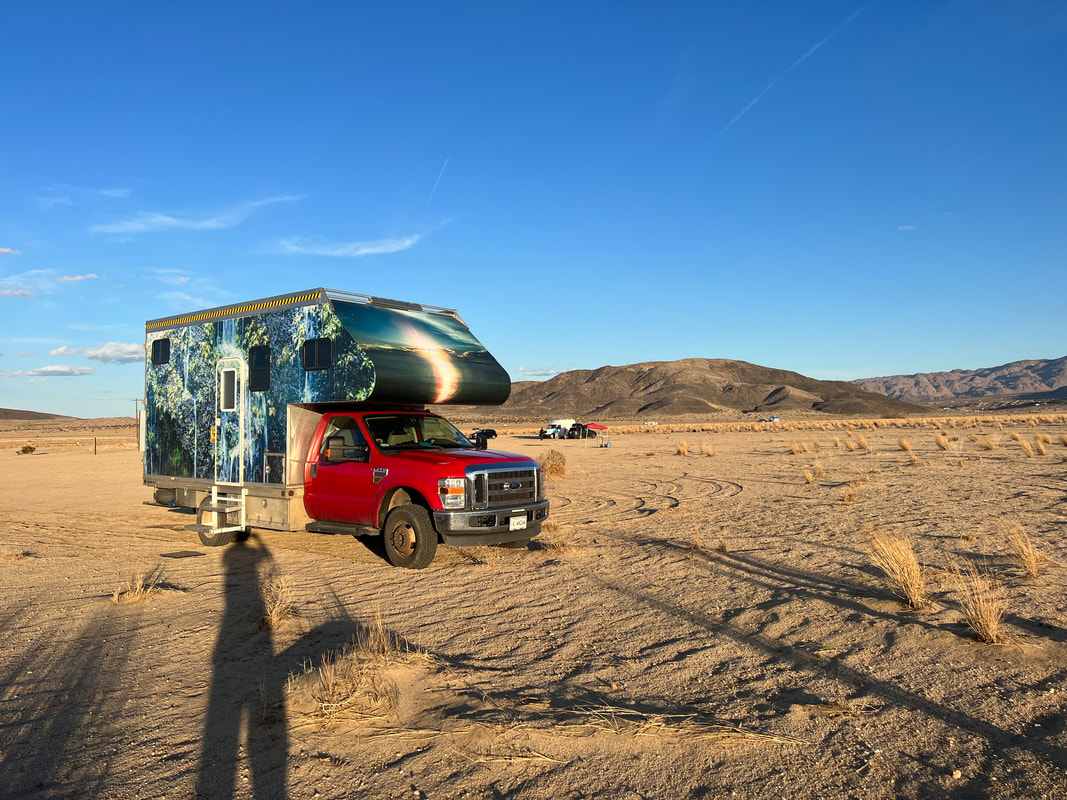
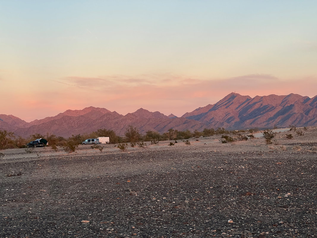
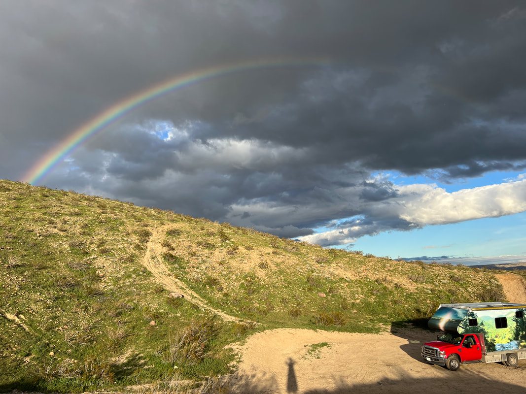
After restocking with groceries and filling with fuel, we didn’t get out of Huntington Beach until after 1pm. Despite the fact that days are getting longer, we knew we wouldn’t make it all the way to Death Valley on Sunday afternoon. I pulled out my trusty apps looking for a place to stay, and found BLM land in Jawbone Canyon, which is about 100 miles shy of Death Valley. While Jawbone Canyon is not a favorite among RVers because the area is primarily for moto and OHV use, it was perfect for us. Clearly marked campsites are spread out along the paved road, and no tricky driving is required. A few remaining off-road riders were still in a few of the campsites, but we easily found an empty site. We parked and took the dogs for a walk up the road, and enjoyed watching the moto riders use the park. Many of the reviews on the apps complained about the off road use, but since that is the designated use for this area, I’m not sure why people would rather complain than enjoy watching people have fun. We thought about some of our friends who enjoy riding like that, and how much they would like the place. We’re impressed with how the government handles the land, offering free classes for minors, which not only teaches the kids how to ride safely and responsibly, but also encourages the adults to do so as well so they can set a good example for the kids. We ended up spending another night in Jawbone Canyon on our way out of Death Valley, and had two moto riders pull up behind the camper and shut off their bikes. Tom jumped out to talk to them (I was making dinner and couldn’t leave food out on the counter with the dogs) and found that they just wanted to tell us how much they liked the camper and to see if we really were from Belize. Tom asked them about riding in the area, and by the time the guys set off and Tom came back in the camper, they were all laughing and doing fist bumps. It occurred to us that a lot of RVers would have most likely locked their doors and yelled “Go Away” out the window, and would never have realized how easy it is to make friends.

Before leaving Jawbone Canyon and heading towards Death Valley, we had to help jumpstart a car for a young couple who had been camping a few campsites down the road, so we didn’t get on the road until after 11. Despite clear roads with high speed limits, we didn’t make great time because of the wind. And, to get into the park, you have to go over two 4000+ foot passes, which makes for slow going with a top-heavy diesel truck. Our original plan had been to go to one of the disbursed campsites in the park, but those require a permit, and the ranger stations were closed by the time we got there. So, we spent our first night at the Stovepipe Wells campground, which is nothing more than a parking lot with RV-sized spaces. But, it’s also only $7 with our America the Beautiful National Parks pass, and there’s a bar where we could get wifi to check in with friends who track us since our cell service had disappeared somewhere in the passes.

The next morning, we went to the ranger station and got a pass for a disbursed campsite on the Echo Canyon Road. We found that they assign you a specific space, which is free, and on a first come, first served basis. We headed off in the general direction of Echo Canyon, with stops at the Mesquite Flats Sand Dunes, the Harmony Borax Works, the Furnace Creek Visitor Center, and the Zabriskie Point overlook. It was cold and rainy - not the normal Death Valley weather - so we didn’t spend much time at any of these places, and we found our campsite on Echo Canyon Road in time for lunch. After lunch the weather cleared somewhat, so we took a walk up the road and found that the park service has spaced the campsites out at half mile intervals, so when you’re parked at one, you can’t even see any of the others. We had chosen the first site on the road since we were unsure of road conditions, so the other campers had to pass us to get to their sites, but the road was still only minimally traveled and we thoroughly enjoyed three days and nights in the quiet of the desert.

The campsite is just a pull off on the side of the road, and it was very gray and rainy when we arrived.

Later in the afternoon the weather cleared, and we realized how beautiful the desert can be.
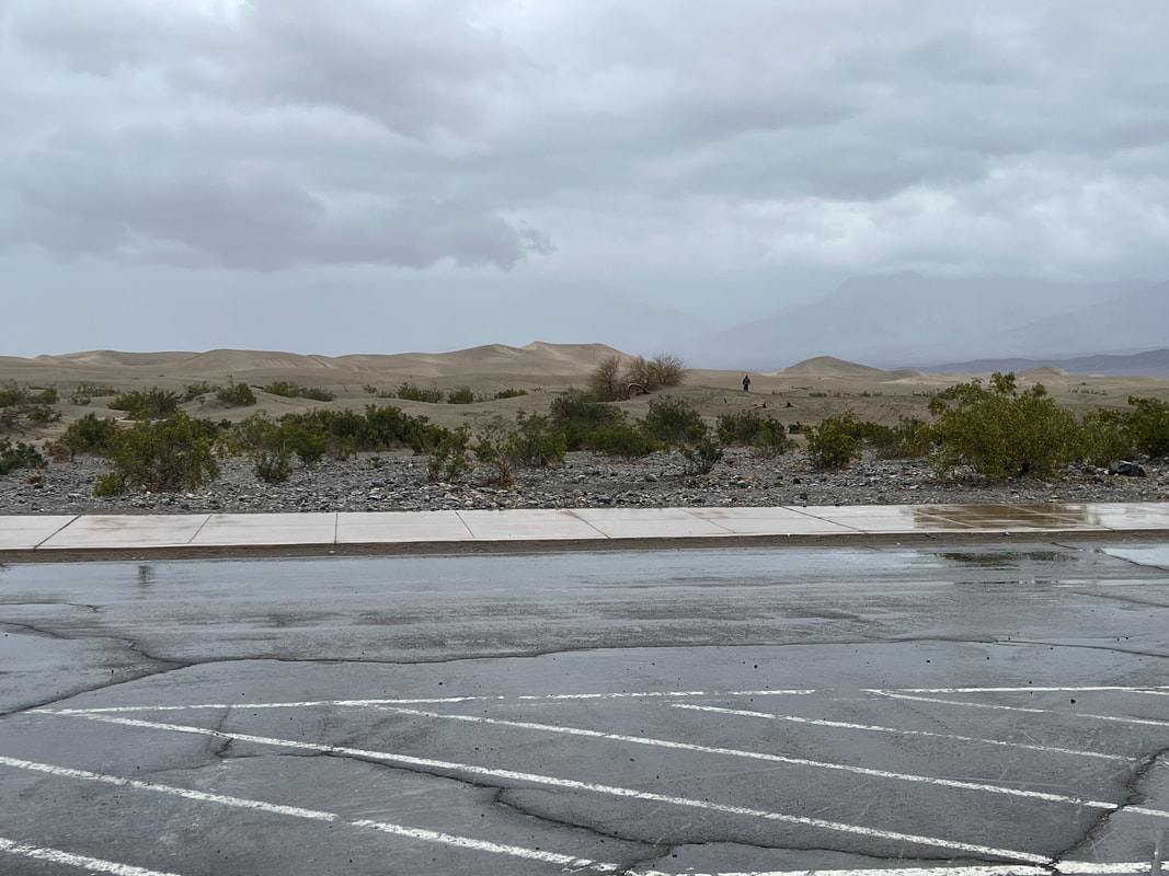
We stopped to see the Mesquite Flats Sand Dunes on our way to Furnace Creek. Between our dislike of sand and the thoroughly nasty weather, we didn’t even get out of the truck.

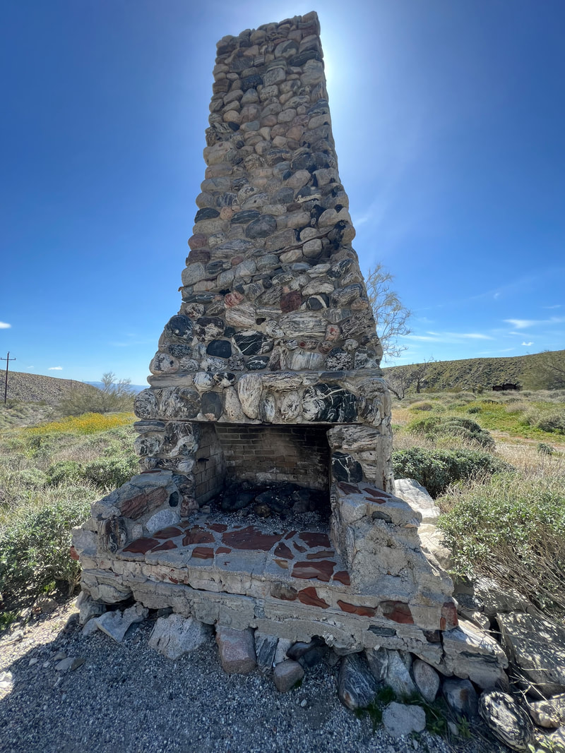
We took a walk around the ruins of a borax mine, and saw the train which required 20 mules to pull.
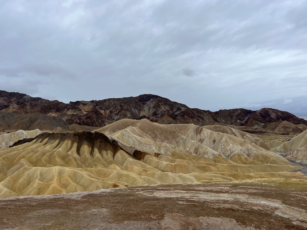
We took a short walk at Zabriskie Point to get a view of the badlands. We decided to wait until the weather cleared to take the longer hike, which we did a couple of days later.
We spent the next two days using our motorbikes to get to other areas of interest in that part of the park. We rode down to Badwater to see the salt flats, and stopped at the Natural Bridge on our way back to the camper. The next day we rode to see the Devil’s Golf Course, and took a cruise around Artists Drive, before parking at Golden Canyon for a hike through Golden Canyon to the Red Cathredral, using Gower Gulch as the return route. We considered extending for another night at the campsite to see a little more of the area, but by the time Tom got to the Visitor Center on Friday morning, someone had already reserved our site for the night. We could have moved up the road, but decided instead to move on and see other areas of the park.
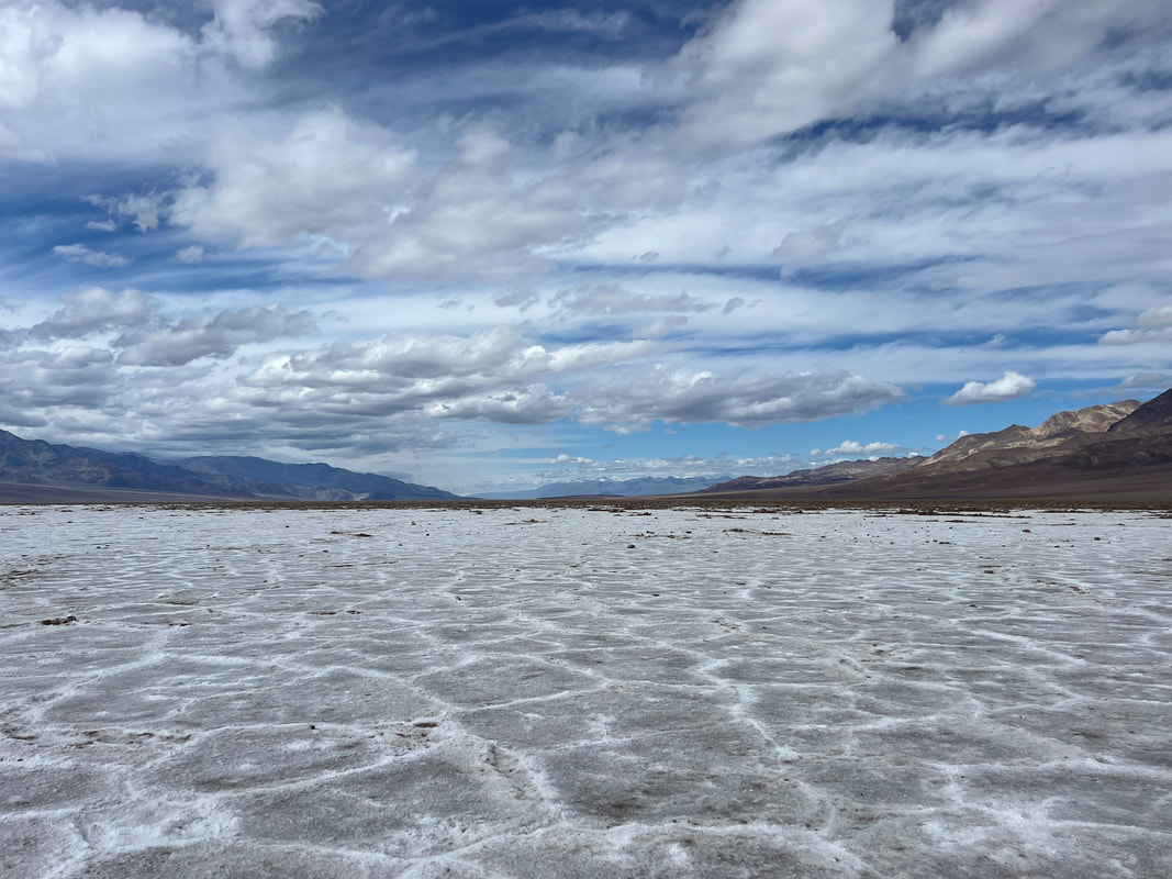
The Badwater Salt Flats are on the lowest point in the US, about 270 feet below sea level.

The Natural Bridge is just up the road from the Badwater Salt Flats, and is just a short hike from the parking lot.

The Devil’s Golf Course looks like piles of plowed up dirty snow, but it is really rock hard salt formations that are difficult to even walk through.,
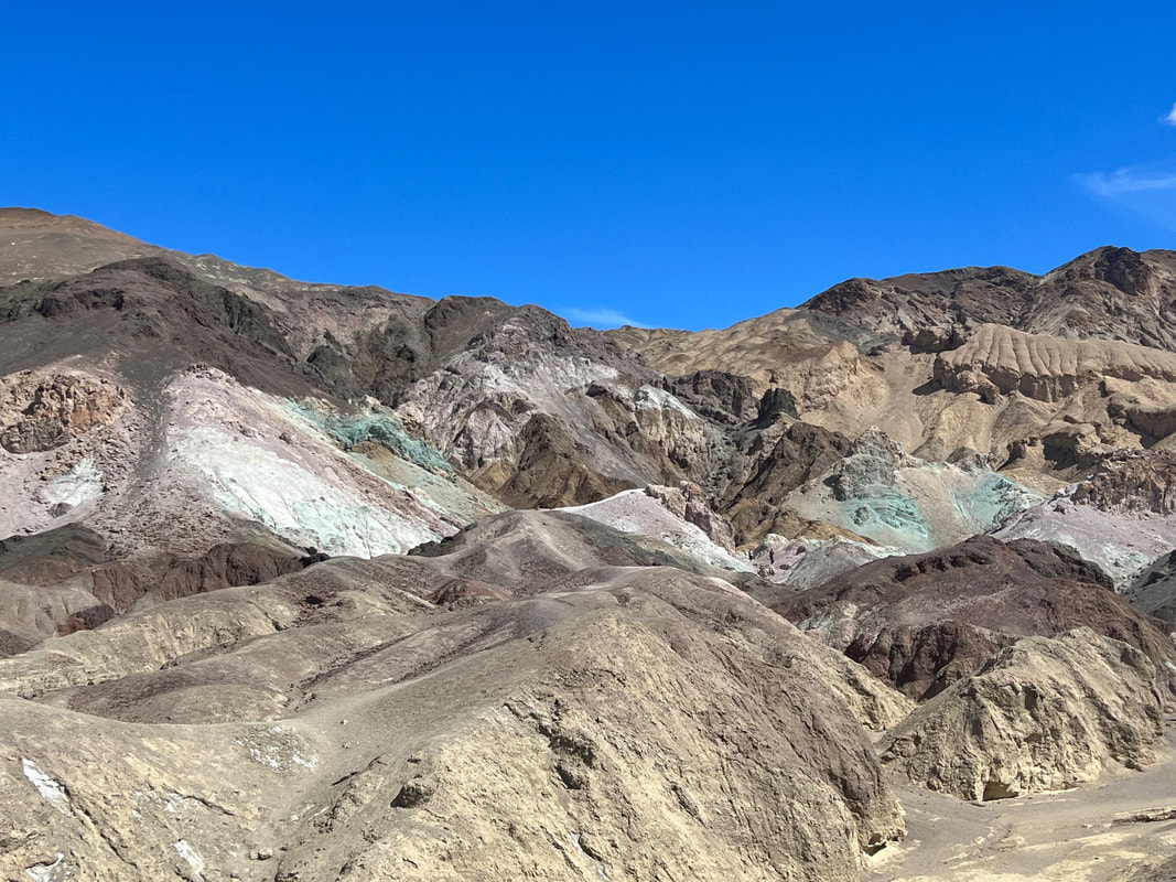
Artists Drive was a fun ride on my scooter, and it took us to the Artists’ Palette site where we saw rocks of every color. I was fascinated with the green rocks because they weren’t copper, as I expected, but some sort of green chloride.

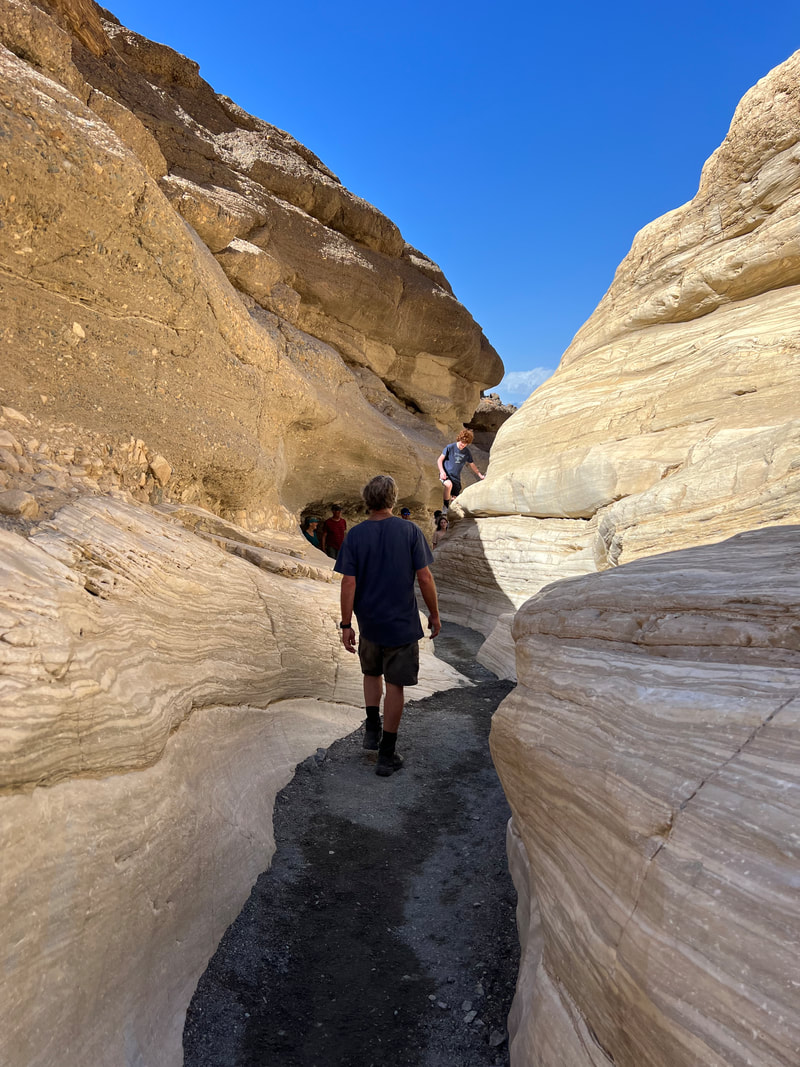
We ended the day with a long hike through Golden Canyon to the Red Cathedral, exiting through Gower Gulch. We saw a different dramatic view in every direction, and were fascinated with how quickly the same view would change as lighting and perspective changed.
Before heading north, we went back to Stovepipe Wells for a hike in Mosaic Canyon, which was wonderful. The rock formations are beautiful, and the hike is challenging as you have to climb up a number of small dry falls, but not scary, and a lot easier heading down. We then headed north, and it was after 5 by the time we got to the Mesquite Springs Campground. We had considered doing disbursed camping on the dirt road south of the Ubehebe Crater, but since it was getting late we decided to check out the campground, and were very glad we did. It’s the same price as the Stovepipe Wells parking lot, so we were worried that it was going to be another campground like that, but it’s a very nicely laid out campground with large campsites with fire rings and picnic tables, and gorgeous views from every site. It also has a dump station and fresh potable water, so it was well worth the $7 to be able to dump our gray water and fill our fresh tanks before heading to the crater in the morning.
This is the typical tourist’s photo of Mosaic Canyon, but the 2 mile stretch of canyon had so many interesting features that if I started posting photos, I’d never finish the blog post.

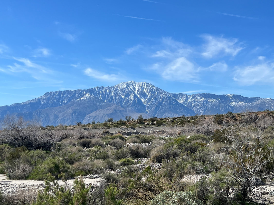
Mesquite Springs Campground is nestled in a valley surrounded by snow-covered mountains.
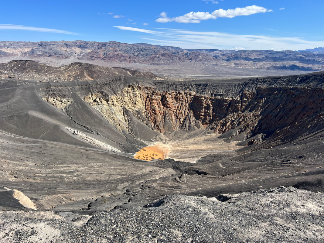
The Ubehebe Crater is a deep crater, and the park service has made trails which go around the big crater as well as a few smaller craters in the area, and down into the Ubehebe Crater. Hiking is a little difficult since you have to slog through lava scree, but the views and the experience are well worth it. We climbed over 1000 feet between going to the top to see the other craters, and going to the bottom just because we could, so we felt like we’d had a pretty good workout before lunch.

One thing about Death Valley which was different for us than the other parks we’ve visited was that suddenly, everybody talked to us. People haven’t been unfriendly or hostile so far on our trip, but very few people have actually stopped to have conversations. In Death Valley, we talked to people at every stop, and we really appreciated all the information they shared, and only hope that we shared things that will help them as well. One of the things that kept coming up was that we were told we had to go hike Titus Canyon, so that’s where we went after the crater even though that hadn’t been on our list of things to see. After a bumpy three miles to the trailhead, we found that there were two hikes, with one being a 3-mile round trip into Titus Canyon, and the other being a 6-mile round trip into Fall Canyon. When we got to the parking lot, we saw the RV of one of the people who had recommended the hike. Since we knew they had hiked Titus Canyon the previous day, we decided to hike Fall Canyon so we would run into them. As it turned out, they were hiking Titus Canyon so we didn’t see them, but they left a note and some snacks duct taped to our truck window. Despite missing them, we were very glad to have hiked Fall Canyon since it ended at an actual waterfall.

Our original intention had been to head west towards Beatty after our hike, and then head north towards Reno the next day. But, since we were again looking at the end of the day, we decided to head back to Stovepipe Wells and spend another night in the parking lot and use the bar’s wifi to check internet stuff, which we had not been able to do since Monday night. We had wrongly assumed that we’d get cell reception somewhere in the park, and when we found that we didn’t, we didn’t think it was worth driving all the way back to Stovepipe Wells. But, we figured we should at least check the weather before heading towards Reno since we also hadn’t looked at a weather report since Monday, and while the Death Valley weather had been very nice with nights in the 50s and days in the 70s, we knew that the below sea level weather wasn’t necessarily indicative of what the weather was like outside of the park.
That turned out to be a very good decision. We got to the bar, ordered our beers, and turned on our phones. The frantic dings after being off line for five days were a little distressing, and even more distressing when we started reading our messages. We have friends in Belize who track us, and we’re usually pretty good about telling them when we’re heading into a no internet zone. But, because we hadn’t realized that we wouldn’t be anywhere to get any reception for five days, we hadn’t said anything. So, after trying various ways to reach us, they had called the park rangers and set them out to find us. We never even knew it happened because the rangers looked up our back country permit, went to make sure our camper was where it was supposed to be when we were out, and reported back to our friends that we were fine and out on our motorbikes for the day. We’re not quite sure how they knew that, unless they had noted the motorbikes on an earlier drive by and figured it out since both we and the motorbikes were gone, but it was enough information to set our friends’ minds at ease, at least until we checked in personally. The rangers never talked to us, so we had no idea what was happening, and we hadn’t given our Belize friends’ number as the emergency contact because we used my California brother since if anything happened, he would have been in a better position to do something. We’ve now promised to do better at letting people know when we’re going off-grid.
Once that confusion was processed, we got back to our original intent and checked the weather for Reno. We were distressed to find that temperatures in Reno were predicted to be in the dangerously-cold-for-our-camper zone. We talked about heading to Las Vegas for a couple of days to see if it would warm up, but decided to check the weather again in the morning and make the decision then. In the morning, nothing had magically changed, so we decided to abandon the plan to head to Nevada and go west again.
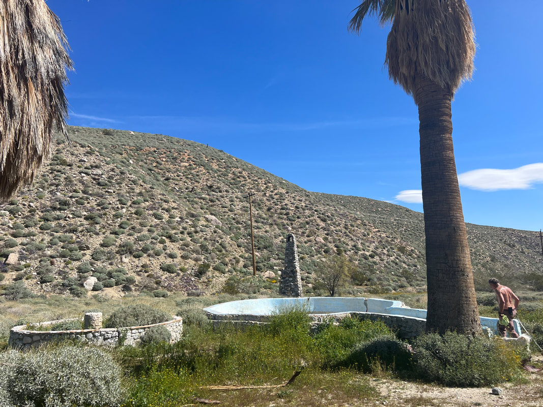
We took our time getting out of the park, the same way we had entered it six days previously. We didn’t exactly follow our route since we had to stop for groceries in Ridgecrest, but we did end up spending another night in Jawbone Canyon. We left in the morning with Pinnacles National Park as our ultimate goal, knowing we probably wouldn’t get there in one day. We saw a sign on US58 for the Cesar Chavez National Monument, which was just a half mile off the highway, so we stopped there for a walk around. Unfortunately the Visitor Center and the garden were closed, but we were able to walk around the compound and see the first signs of spring with the flowering trees. The Cesar Chavez National Monument was created as a monument to the farm workers’ labor movement, which was led by Cesar Chavez and his wife. The property was a tuberculosis treatment center prior to the Chavezes purchasing it and moving there in 1971, where they made it their home and farm as well as a meeting place for the labor movement. Helen Chavez lived in the small house on the property until she died in 2016, when she was buried next to her husband in the garden.
That turned out to be a very good decision. We got to the bar, ordered our beers, and turned on our phones. The frantic dings after being off line for five days were a little distressing, and even more distressing when we started reading our messages. We have friends in Belize who track us, and we’re usually pretty good about telling them when we’re heading into a no internet zone. But, because we hadn’t realized that we wouldn’t be anywhere to get any reception for five days, we hadn’t said anything. So, after trying various ways to reach us, they had called the park rangers and set them out to find us. We never even knew it happened because the rangers looked up our back country permit, went to make sure our camper was where it was supposed to be when we were out, and reported back to our friends that we were fine and out on our motorbikes for the day. We’re not quite sure how they knew that, unless they had noted the motorbikes on an earlier drive by and figured it out since both we and the motorbikes were gone, but it was enough information to set our friends’ minds at ease, at least until we checked in personally. The rangers never talked to us, so we had no idea what was happening, and we hadn’t given our Belize friends’ number as the emergency contact because we used my California brother since if anything happened, he would have been in a better position to do something. We’ve now promised to do better at letting people know when we’re going off-grid.
Once that confusion was processed, we got back to our original intent and checked the weather for Reno. We were distressed to find that temperatures in Reno were predicted to be in the dangerously-cold-for-our-camper zone. We talked about heading to Las Vegas for a couple of days to see if it would warm up, but decided to check the weather again in the morning and make the decision then. In the morning, nothing had magically changed, so we decided to abandon the plan to head to Nevada and go west again.
We took our time getting out of the park, the same way we had entered it six days previously. We didn’t exactly follow our route since we had to stop for groceries in Ridgecrest, but we did end up spending another night in Jawbone Canyon. We left in the morning with Pinnacles National Park as our ultimate goal, knowing we probably wouldn’t get there in one day. We saw a sign on US58 for the Cesar Chavez National Monument, which was just a half mile off the highway, so we stopped there for a walk around. Unfortunately the Visitor Center and the garden were closed, but we were able to walk around the compound and see the first signs of spring with the flowering trees. The Cesar Chavez National Monument was created as a monument to the farm workers’ labor movement, which was led by Cesar Chavez and his wife. The property was a tuberculosis treatment center prior to the Chavezes purchasing it and moving there in 1971, where they made it their home and farm as well as a meeting place for the labor movement. Helen Chavez lived in the small house on the property until she died in 2016, when she was buried next to her husband in the garden.

We continued into Bakersfield with a stop for a few grocery items we’d forgotten the day before. We realized we wouldn’t make it to Pinnacles National Park, so we started looking for places to camp between Bakersfield and the park. FreeRoam and iOverlander let us down again since everyplace we found had some comment that discouraged us from heading in that direction, so I looked at Campendium, which again came through for us with the Condon Peak Recreation area. We set the GPS systems and were on our way.